Mt. Whitney Webcam 1

Webcam 1 Legend
Mt. Whitney Webcam 2

Webcam 2 Legend
Mt. Whitney Timelapse
Owens Valley North

Owens Valley North Legend
Owens Valley South

Owens Valley South Legend
Previous Thread
Next Thread
Print Thread
Page 2 of 2 1 2
Joined: Dec 2010
Posts: 5
Member
Member

Joined: Dec 2010
Posts: 5
Sounds like several people have been up as far as the portal since the big system moved through last week. Several friends and I are planning to hike up into the Whitney Zone next week (the first week of January). We made a similar trip around the same time last year up to trail camp. We are fully prepared for the low temps and slow going due to ice and snow accumulation, but were wondering if anybody had actually hiked anywhere up past the portal. Any information on how the snow is packing down, it's stability, and trail conditions (if any) would be really helpful. If nobody has been past the portal.... we'll probably still come out and give it a go, though we may just end up doing an hour or two of snow removal for the Subaru.

Joined: May 2007
Posts: 585
Member
Member

Joined: May 2007
Posts: 585
Keep an eye on the weather forecast - this site is a good start. An intense, but fast-moving storm will go thru tonight/tomorrow, then turn cold.

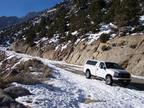
You've seen the thread related to the stranded Forester. Sometimes the actual snow level is lower than the "Road Closed" sign at the 6K' point. If snow is forecast during your trip, consider dropping your friends/gear as high as you can safely drive, and then park the car a mile or so below the current snow level.

Having Doug's phone number in your cell is a good idea. Or better yet, stop by the Whitney Hostel and ask if they have any info on current conditions.

Joined: Jan 2010
Posts: 59
Member
Member

Joined: Jan 2010
Posts: 59
Hey you locals! What are road conditions like lately (sans Subaru)?

Sorry to sound rude...all of us who live far from Lone Pine live in perpetual jealously of your proximity and Mt. Whitney wisdom...

Joined: Dec 2002
Posts: 3,014
Likes: 3
Member
Member

Joined: Dec 2002
Posts: 3,014
Likes: 3
Hi Just got back from a drive to check the road . You can get almost to the road closed sign before you hit ice, melting very fast now but only creating more ice each night, last week we added a 1000 pounds to the back of a lifted 4x4 with chains and got 200' past the road closed sign.
But the slope up from the road closed sign is clearing and cuts off about 2 miles. Thanks Doug

Joined: Jan 2010
Posts: 59
Member
Member

Joined: Jan 2010
Posts: 59
Thank you, Doug!

Joined: Mar 2009
Posts: 330
Member
Member

Joined: Mar 2009
Posts: 330
I'm considering heading up Thursday or Friday to try the "unpassable" switchbacks on the main trail. Has anybody been up the road since Doug was there on 1-14? How far do you thing I can go with a low-clearance 2WD Acura with wide tires and not much tread? How far would I get with a F250 4WD with new A/S tires? Finally, has anybody been considerate enough to pack the trail for me up to Trail Camp? Thanks!

Joined: Mar 2009
Posts: 330
Member
Member

Joined: Mar 2009
Posts: 330
The road is dry to the "ROAD CLOSED" sign. There are two substantial sections of icy rutted snow between the sign and the first switchback. The snow gets much deeper a few hundred yards after the first switchback. After a while, there is a long section that is mostly snow free. There is solid snow starting shortly below the campground. There are many huge boulders in the road above the first switchback.

Conditions may change rapidly, but for now, I would recommend that 2WD vehicles park at the sign and 4WD/AWD vehicles park at the first switchback.

Here is a photo from January 27:

Joined: Jul 2010
Posts: 19
Member
Member

Joined: Jul 2010
Posts: 19
What are the current road conditions? We're heading up the weekend of April 16th.

Joined: Apr 2011
Posts: 1
Member
Member

Joined: Apr 2011
Posts: 1
Hi Paul,

Could you send out an update on this? I'm heading up the 23rd.

Thanks!

Joined: May 2008
Posts: 380
Member
Member

Joined: May 2008
Posts: 380
Originally Posted By witold
Hi Paul,

Could you send out an update on this? I'm heading up the 23rd.

Thanks!


http://www.whitneyportalstore.com/forum/...age=1#Post83699

last post is most current information

Joined: May 2011
Posts: 2
Member
Member

Joined: May 2011
Posts: 2
Road opened up last week, no snow or ice all the way up to the store. We drove up this past weekend.

Page 2 of 2 1 2

Moderated by  Doug Sr 

Link Copied to Clipboard
Mt. Whitney Weather Links


White Mountain/
Barcroft Station

Elev 12,410’

Upper Tyndall Creek
Elev 11,441’

Crabtree Meadows
Elev 10,700’

Cottonwood Lakes
Elev 10,196’

Lone Pine
Elev. 3,727’

Hunter Mountain
Elev. 6,880’

Death Valley/
Furnace Creek

Elev. -193’

Powered by UBB.threads™ PHP Forum Software 8.0.0
(Release build 20240826)
Responsive Width:

PHP: 7.4.33 Page Time: 0.110s Queries: 39 (0.077s) Memory: 0.7472 MB (Peak: 0.8496 MB) Data Comp: Off Server Time: 2025-04-11 22:34:07 UTC
Valid HTML 5 and Valid CSS