|
|
Joined: Dec 2002
Posts: 3,010 Likes: 3
Member
|
|
Member
Joined: Dec 2002
Posts: 3,010 Likes: 3 |
A few fires in California , we have smoke in the canyon and last night wind must of shifted my eyes were burning around 10 PM and could feel the burn in the throat. We have had worse and tried to hike in the smoke , you can not move quickly ,the air burns your throat and will make you cough. Sometimes the air will clear above 11,000-12,000 feet but I am sure you may have caused lung damage hiking in these conditions .
We are having request for products / items that you should be able to get in the City. Take note as you travel 13 miles to the end of the road the drinks with the nice design are only served after Nov. 1 on some years.
Campground full every night and the bears are very active breaking into cars and trucksand walking up to the open bear boxes as you are loading or unloading.
Added to this mask required in INYO County Indoors or OUTDOORS IF YOU can't maintain the 6 foot distance which will include the Whitney Trail and Portal since these are outside and gathering in groups fall into this rule. Hint Inyo County has now taken #1 in the State based on population for Covid and 9 deaths as of last night. So like the old TV show barker would say Come on down!
|
|
|
|
|
Joined: Dec 2003
Posts: 447
Member
|
|
Member
Joined: Dec 2003
Posts: 447 |
I'm selecting door #3 for right now.
The message here is like Bob Barkers quote "You can't fool television viewers with dancing girls and flashing lights."
|
|
|
|
|
Joined: Jan 2003
Posts: 965
Member
|
|
Member
Joined: Jan 2003
Posts: 965 |
I prefer lagers to lattes anyway.
|
|
|
|
|
Joined: Dec 2002
Posts: 984
Member
|
|
Member
Joined: Dec 2002
Posts: 984 |
Drinking a lager is the beverage equivalent of hiking up George Creek...
|
|
|
|
|
Joined: Jan 2003
Posts: 965
Member
|
|
Member
Joined: Jan 2003
Posts: 965 |
A few fires in California , we have smoke in the canyon and last night wind must of shifted my eyes were burning around 10 PM and could feel the burn in the throat. We have had worse and tried to hike in the smoke , you can not move quickly ,the air burns your throat and will make you cough. Sometimes the air will clear above 11,000-12,000 feet but I am sure you may have caused lung damage hiking in these conditions. There's no smoke above the 15,000-foot level on Rattlesnake Hill.
|
|
|
|
|
Joined: Jan 2003
Posts: 965
Member
|
|
Member
Joined: Jan 2003
Posts: 965 |
Oh, yeah? Well, Barbara Lilley and I are sharing a pitcher of lager right now.
|
|
|
|
|
Joined: Mar 2006
Posts: 298
Member
|
|
Member
Joined: Mar 2006
Posts: 298 |
Three of us climbed the Swiss Arête on Mount Sill five years ago during the Walker Fire. Smoke was heavy and we had already hiked to the base of the climb and summit fever propelled us on. We paid for it with stinging eyes, coughs and didn’t feel good for a few days afterwards. Yes, we got the summit, but learned a valuable lesson. NEVER again climb in thick smoke. The view that wasn’t. The lungs that suffered. 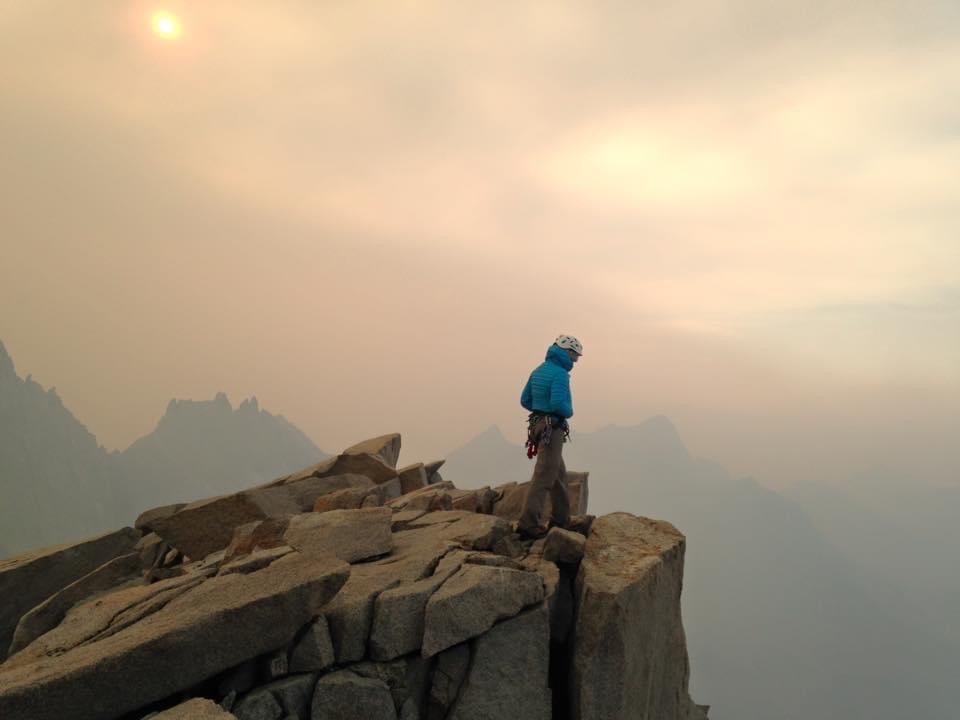
|
|
|
|
|
Joined: Dec 2002
Posts: 984
Member
|
|
Member
Joined: Dec 2002
Posts: 984 |
Oh, yeah? Well, Barbara Lilley and I are sharing a pitcher of lager right now. Señor, I surfed with Barbara Lilley. I knew Barbara Lilley. Barbara Lilley was a friend of mine. Señor, Barbara Lilley was no lager drinker! (As you well know, she said upon reaching most summits: "Ales, baby. It's all about the ales.")
|
|
|
|
|
Joined: Mar 2006
Posts: 298
Member
|
|
Member
Joined: Mar 2006
Posts: 298 |
I know where there is still a register with few sig’s that she and Gordon placed. A not often visited peak in Death Valley. She’s prolly there right now sipping two fingers of scotch whiskey.
|
|
|
|
|
Joined: Jan 2003
Posts: 965
Member
|
|
Member
Joined: Jan 2003
Posts: 965 |
Yes, I happen to know Ms. Lilley likes a little Lagavulin with her lager.
|
|
|
|
|
Joined: May 2008
Posts: 4
Member
|
|
Member
Joined: May 2008
Posts: 4 |
I’m trying to contact “Norma R†(posted the smokey picture) but am unable to PM her. The mailbox said she reached her limit. Norma please email me at woxdogs@gmail.com. Thanks.
|
|
|
|
|
Joined: Dec 2002
Posts: 499
Member
|
|
Member
Joined: Dec 2002
Posts: 499 |
Was also trying to PM Norma. Norma? PM box cleaning time?
|
|
|
|
|
Joined: Feb 2005
Posts: 135
Member
|
|
Member
Joined: Feb 2005
Posts: 135 |
Great info. From rather frequent checks of the smoke tracking maps, it looks like some parts of the days this week have still been very smokey in the Whitney Zone, from the fire just to the south and all the others, with some periods of clear air too. Has that been the actual experience on the ground as well? I have a permit for this weekend, but obviously do not want to get overly optimistic and make the mistake of starting out in a clear spell only to get socked in with hours of smoke later in the same day or overnight. I realize of course that no one can predict the air on a particular day, just interested to hear observations from the past few days. Thanks!
|
|
|
|
|
Joined: Mar 2006
Posts: 298
Member
|
|
Member
Joined: Mar 2006
Posts: 298 |
I had forgotten about the PM box. Turns out I hadn't used it in three years and had never emptied it since my first message way back when. Had fun perusing the messages and it will now accept new messages. Thanks for letting me know.
Norma
|
|
|
|
|
Joined: Dec 2003
Posts: 447
Member
|
|
Member
Joined: Dec 2003
Posts: 447 |
This reminded me that somewhere in old photos I have a register photo with Barbara Lilley and John Wedburg signature on the same page. Must find this
|
|
|
|
|
Joined: Dec 2002
Posts: 3,010 Likes: 3
Member
|
|
Member
Joined: Dec 2002
Posts: 3,010 Likes: 3 |
Smoke update some mornings clear,but at some point during the day the smoke will build in the canyon,some hikers not having trouble,many not going as the west side trail Crest to the summit may have heavy smoke before the Eastside,no reports from Horseshoe Meadow hikers but would expect they are in the smoke same with Onion Valley to Whitney.Many roads and trails closed south and west so check Park service sites for closures.
|
|
|
|
|
Joined: Dec 2002
Posts: 984
Member
|
|
Member
Joined: Dec 2002
Posts: 984 |
You mean this, or is that just the warm smell of colitas...? 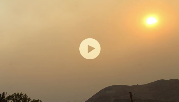
|
|
|
|
|
Joined: Jul 2007
Posts: 696
Member
|
|
Member
Joined: Jul 2007
Posts: 696 |
Better than the warm smell of colitis...
|
|
|
|
|
Joined: Dec 2002
Posts: 984
Member
|
|
Member
Joined: Dec 2002
Posts: 984 |
Eh? I thought that's what I put. Damned autocorrect! 
|
|
|
|
|


