|
|
|
Anonymous
Unregistered
|
|
Anonymous
Unregistered
|
Thanks to one of our USMC pilots...
SEMPER FI!


|
|
|
|
|
Joined: Jun 2005
Posts: 750
Member
|
|
Member
Joined: Jun 2005
Posts: 750 |
Thanks for sharing. And thanks to the pilot. Great pictures. 
|
|
|
|
|
Joined: Nov 2005
Posts: 176
Member
|
|
Member
Joined: Nov 2005
Posts: 176 |
Wow! fantastic scouting shots. Can we get the pilot on retainer???
Andy
|
|
|
|
|
Joined: Jan 2007
Posts: 612
Member
|
|
Member
Joined: Jan 2007
Posts: 612 |
Spectacular shots!!! From this view I can't believe I actually climbed something like that. Any chance someone could mark landmarks to give a perspective of where locations are. I am very disoriented as to where Lone Pine Lake, Trail Crest and the switchbacks are from this view. Thanks.
|
|
|
|
|
Joined: Dec 2007
Posts: 16
Member
|
|
Member
Joined: Dec 2007
Posts: 16 |
very nice photos for sure.
i have a request if you don't mind sir, did you take any of the evolution valley or any of the interior (i.e.) anywhere along the john muir trail location?) thanks again. p.f.c. robo hiker;-)
on on
|
|
|
|
|
Joined: Jan 2007
Posts: 57
Member
|
|
Member
Joined: Jan 2007
Posts: 57 |
Great photos! Sometimes I wish I choose flying as a career.
Any more shots would be greatly appreciated.
I remember seeing many many military fighters playing around during the 3 days I spend in the Whitney area last summer. I saw them showing off and really pushing their aircraft. I never got buzzed though.
I was hiking east on the High Sierra Trail and as soon as I topped out at Kaweah Gap I got buzzed by an extrememly low red and blue lone fighter. If he was inverted I would have been able to see his face! It was very cool, although questionably legal.
|
|
|
|
|
Joined: Jan 2003
Posts: 389
Member
|
|
Member
Joined: Jan 2003
Posts: 389 |
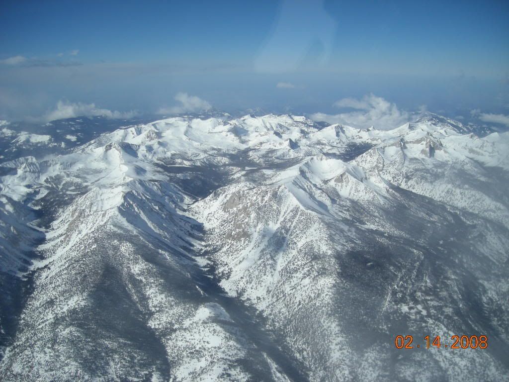
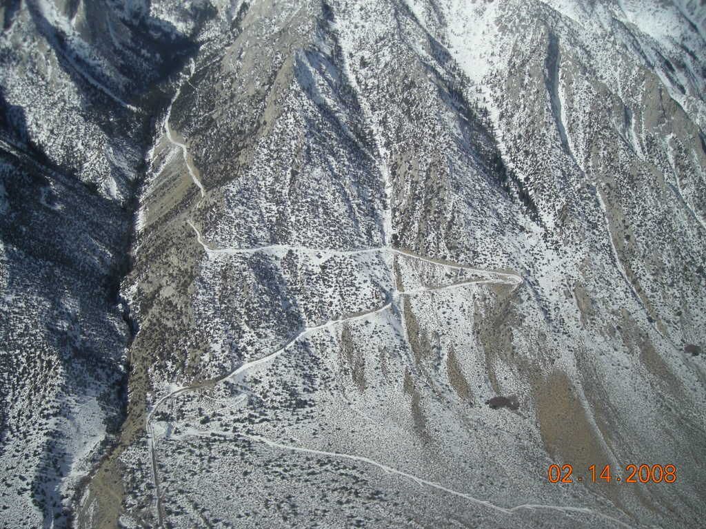
Thanks Dale.Is the main trail then on the left of the most left ridge in the first picture?(nice english) The main trail starts with a single big switchback to a crossing of the north fork of Lone Pine Creek. After the crossing the trail's first set of switchbacks climbs in the trees at the base of the ridge that comes NE off of Thor. (The bottom of that ridge comes straight towards the camera.) I think these switchbacks may be in view but hidden in trees. The trail then traverses SW and starts a second set of switchbacks that climb almost to the level of Lone Pine Lake. The second set of switchbacks are out of sight behind the rock ridge on the south side of the Portal. It's hard to see the edge of that ridge against the side of the ridge off Thor because both are backlit. The top edge of Thor is hard to discern for the same reason. Dale B. Dalrymple http://dbdimages.comhttp://stores.lulu.com/dbd
|
|
|
|
|
|
Anonymous
Unregistered
|
|
Anonymous
Unregistered
|
very nice photos for sure.
i have a request if you don't mind sir, did you take any of the evolution valley or any of the interior (i.e.) anywhere along the john muir trail location?) thanks again. p.f.c. robo hiker;-) Hey there, I spoke to the pilot today (who took those photos) & he said he'd take shots of the Evolution valley for you (and the Evolution Group). He thinks it's within his flying territory. So, maybe this upcoming week, I'll have somethin' for ya!
|
|
|
|
|
Joined: Dec 2007
Posts: 16
Member
|
|
Member
Joined: Dec 2007
Posts: 16 |
[quote=robohiker]very nice photos for sure.
i have a request if you don't mind sir, did you take any of the evolution valley or any of the interior (i.e.) anywhere along the john muir trail location?) thanks again. p.f.c. robo hiker;-) Hey there, I spoke to the pilot today (who took those photos) & he said he'd take shots of the Evolution valley for you (and the Evolution Group). He thinks it's within his flying territory. So, maybe this upcoming week, I'll have somethin' for ya! [/quote/] thanks very much,i'm interested in it because we'll be hiking through there this june on a p.c.t. thru-hike, and i've heard they're having quite a snow year in there. thanks again, p.f.c. robo hiker ;-D
on on
|
|
|
|
|
Joined: Jan 2003
Posts: 2,446
Member
|
|
Member
Joined: Jan 2003
Posts: 2,446 |
For the pilots in the group, here is a fascinating story about the search for Steve Fossett: fossett story
|
|
|
|
|
Joined: Oct 2005
Posts: 39
Member
|
|
Member
Joined: Oct 2005
Posts: 39 |
The pictures of Owens Peak inspired me to climb it today. The beauty of the snow in the pictures belies the truly horrible, rotten, energy-sucking condition of the snow. Right now Owens Peak snow is best enjoyed from an aircraft, unless one has serious masochistic tendencies.
|
|
|
|
|
Joined: Nov 2007
Posts: 138
Member
|
|
Member
Joined: Nov 2007
Posts: 138 |
awsome pictures and everyone in the marine corp should know i thank them for their servivce to our country !!!
|
|
|
|
|
Joined: Jan 2004
Posts: 76
Member
|
|
Member
Joined: Jan 2004
Posts: 76 |
Yes, the pictures are great, but the pilots are greatest.
A few years ago after descending Mt Whitney in winter I went (as usually) to Death Valley. Somewhere on the way, I set my camera on the tripod to take a picture of the Sierra. I looked through the camera to compose the shot and suddenly something big flew into my frame. I was so surprised/scared that instead of taking a picture I looked up to see the creature and got scared again of a quickly passing above my head jet with threatening noise. Well, they got me.
The next day or so, while driving back to Lone Pine, a threatening noise passed me from behind and the jet quickly disappeared in front of my car. They got me again. I loved that experience. Thanks for providing me such excitements.
Also a few years ago I had another experience with jets, this time at the Air Force in Medford, OR. I was let to get as close as possible to lunching jets to take pictures. The plains, one after another, were taking off the ground in front of me. The noise and vibration were so huge that my tripod fell apart. Yes the metal frame broke. I was afraid that my camera lens was going to break too, but it survived. I survived to the end too. It was scary, but, again, I loved the experience.
On many other occasions I've seen these pilots doing amazing things in the sky, also in San Francisco. They are very, very talented and skilled. They are the best!
|
|
|
|
|
Joined: Sep 2005
Posts: 3
Member
|
|
Member
Joined: Sep 2005
Posts: 3 |
Great pics. Thanks a lot!
|
|
|
|
|
|
Anonymous
Unregistered
|
|
Anonymous
Unregistered
|
Thanks!
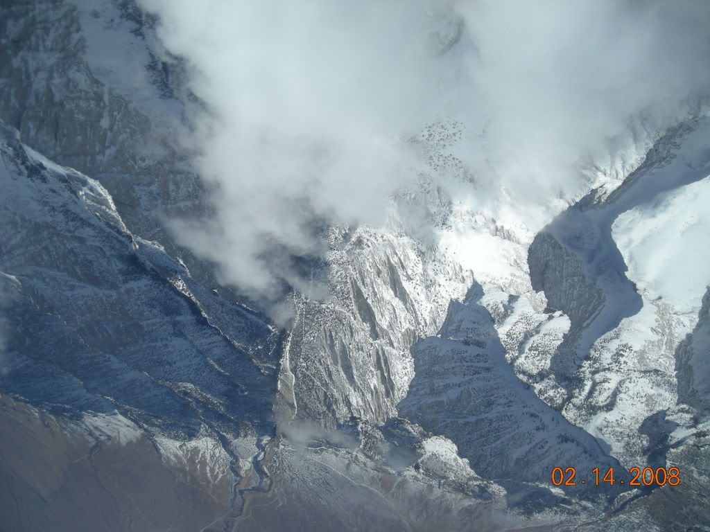
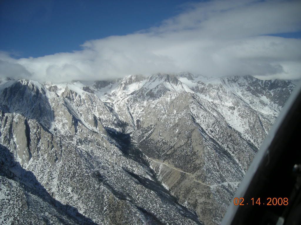
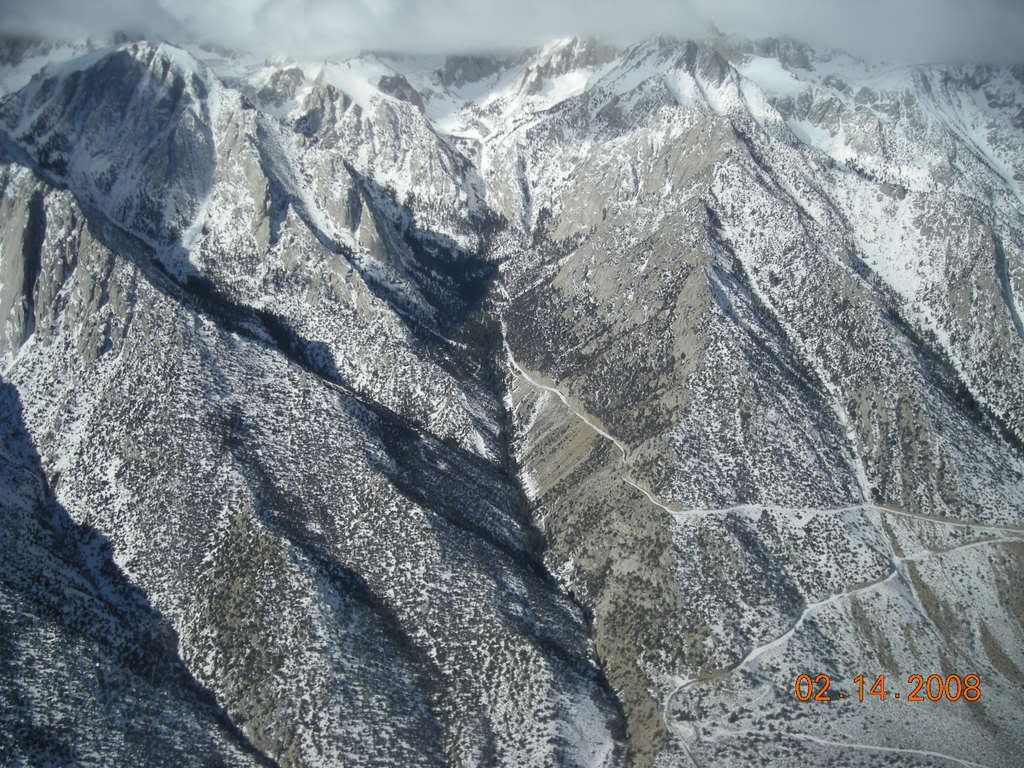
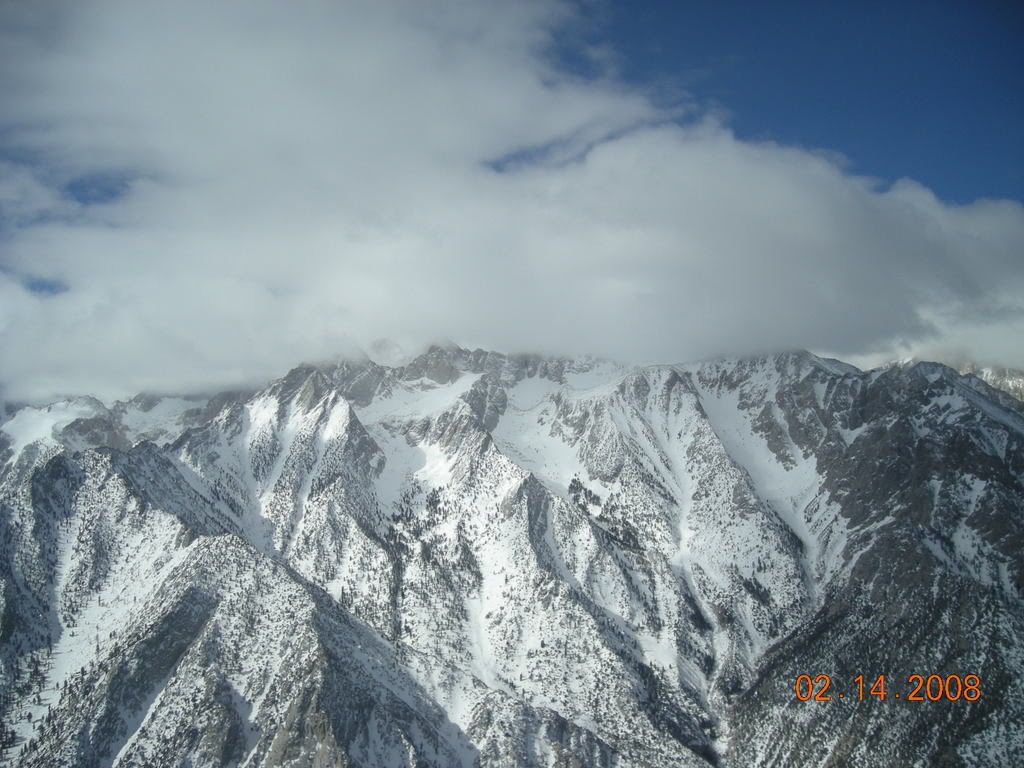
Here are some more shots of MT Whitney and the area taken yesterday, 14 FEB.
We aren't quite sure what mountains were captured in the 1st photo, perhaps someone here can help us!
|
|
|
|
|
Joined: Dec 2007
Posts: 16
Member
|
|
Member
Joined: Dec 2007
Posts: 16 |
more great photos! can anyone i.d. the first one?
i should've been a pilot!
on on
|
|
|
|
|
Joined: Jan 2003
Posts: 548
Member
|
|
Member
Joined: Jan 2003
Posts: 548 |
Great photos, thanks! Always good to see our tax dollars at work for a good cause! If you USMC guys fly a bit farther north, up around Mammoth Mountain, could you take a few photos of Mt. Ritter and Banner Peak from the southeast and east? I have a certain fascination with Mt. Ritter (see my WWW site for an explanation) and would love to have some good aerial shots of the Southeast Glacier and the south/southeast side of Mt. Ritter as well as the surrounding area. Thanks!
|
|
|
|
|
|
Anonymous
Unregistered
|
|
Anonymous
Unregistered
|
Hi Alan, The flying area stops a bit North of Big Pine.  Sorry. On a Whitney note, I hiked up past North Fork today on the Main Trail with Miguel (who summited Wotans Throne). I turned around though because my gloves had fallen out of my pocket, and I wanted to find them. Not much of a boot track past the lake. Also, still couldn't drive much farther past the 'road closed' sign. Nice glissade from the Alabama Hills placard to the portal road (just a bit above the 'road closed' sign). So, I ended up rock climbing @ the Alabama Hills for the rest of the afternoon. It was a sunny, gorgeous day. We also climbed Owens Peak on Sat (fm 1 of the pics above). The snow had consolidated, so the hike up was actually nice. Owens Peak Photos 16 FEB 08
|
|
|
|
|
Joined: Jan 2003
Posts: 548
Member
|
|
Member
Joined: Jan 2003
Posts: 548 |
Ok, thanks anyway. Wasn't sure what the operational area was.
I'll just have to look at the Mt. Whitney pix and wish I were out there again.
If plans work out, my mountains for this year will be Hood, Rainier and Humphreys (AZ state highpoint, just north of Flagstaff).
|
|
|
|
|


