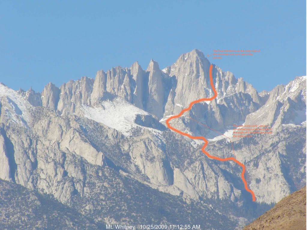
I thought it would be nice to see a general view of the Mountaineer's Route. I just took a snapshot of the Whiteny Webcam and photoshopped a line. Its not entirely accurate because of the angle of the photo but I think it depicts the route in a general way. This is just to give those who are interested in attempting this route a general depiction.
Before I climbed Whitney via the MR I was looking all over the interent for a general view of the route but my search skills could not dig up any.
So enjoy and feel free to comment and help those who have no familiarization with this route.
Sorry for the small font in the captions so the lower caption reads:
"This area of the route I drew is somewhat innaccurate because of the angle of the photo but it gets the point across"
And the upper:
"The Final 400 feet is on the other side of the mountain you can't see in this picture"
BTW, for those that are new to the mountain, the top of the orange line is the "notch."
********Disclaimer: Do not use this photo as a map or route finding resource. I will not be held responsible for anyone's safety or well-being attempting to explore the Mount Whitney area with the aid of this photo or post.
^ I have to put this, never know what can happen