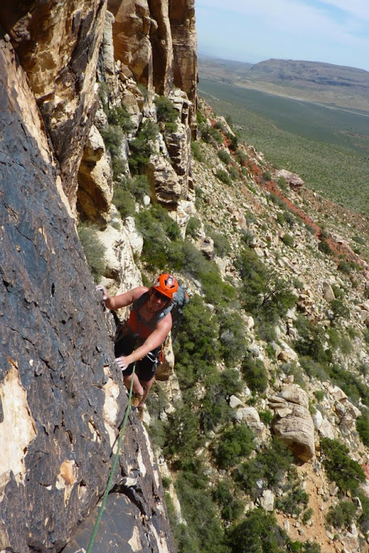
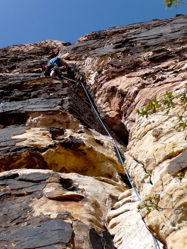
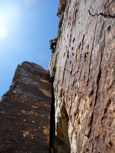
April 17-18, 2010: Red Rocks, NV

The wall didn’t look that steep. Deceptive, really, those sandstone cliffs rising red and white and black for thousands of feet straight out of the green of the desert floor. I could see the holds above us as we waited for a party ahead to clear off the belay anchor, started slowly working out possible combinations for hands and feet to work my way up the wall behind her.
But I wasn’t working them out fast enough, and she didn’t want to wait for so long at the belays. It was reasonable, really, although my ego at first wanted to start thrashing away and bum rush the route. She lowered me to the anchor, and I clipped in, hanging above that desert floor with a glower fixed to my face, disappointed at what I perceived as failure. But in those moments as I stood against the wall, looking up again at the combinations that had eluded me, I switched back into analytical mode. The only failure was not trying, staying on the ground and searching the wall while thinking it was impossible. It was above my pay grade, surely, but I can only get stronger from trying, and as we talked later about the day, I told her how much I appreciated the shot to climb with her. While we’re not compatible as a technical climbing team, we’ve already discussed a few death marches…
Now I know what I have to do, the skills I have to progress. The focus narrowed, and exchanging partners with the gaggle of friends camping out at Red Rocks that weekend, I relaxed and tried to settle into each climb. Geronimo with Ray. Johnnie Vegas with Joan, but surrounded by Migs and Ingrid, Jerod and Luis. Both 5.7 with fun exposure, and everything from mini-roofs to face moves to cracks. The best part was the smiles all around the group after rapping down the gulley and the trudge across the desert back to the roasting cars. Clinks all around from cold brews, grabbing at snacks from coolers, and looking back to the cliffs standing tall and guarding the desert.


April 24-25, 2010: Virginia Lakes and Onion Valley
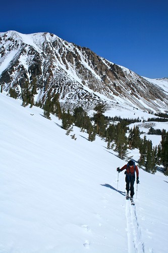
My shoulder was nervous.
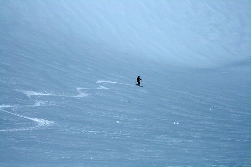
Brent and I skinned up to the bowl above the Virginia Lakes trailhead, and all we were finding was crust, still hard in the late morning hour and not all that forgiving. Gusts blew puffs of spin from high atop Dunderberg Peak to our north, sweeping it down and into our bowl as we sat perched on the final ridge to the top. The other tracks were perhaps not more than a day or two old, already worn and filled from the wind. We broke out shovels to test out the conditions, the first block of 12” shearing a bit too easily off the layer of sugar. The compression test, though, offered a bit more encouragement as I pounded the shovel into the block. No fractures, no propagation, but higher meant steeper and more into the wind. The last time I had been out in the backcountry, I had ended up in the ER, so the thought of a fall was unappealing, at best.
After a long cut across the bowl, Brent dropped in for his first turns, setting a gorgeous line right down the middle of the drainage. I watched enviously as he glided and swung in easy arcs down the cruiser, finally pulling up near the exit and looking back my way. With a deep breath, I started across, finally dropping in to the right of his tracks, jittery over my skis as I worked a little to hard in the snow. I connected a few turns, but then would widen more into a sweeping arc and, with a small stumble, stopping just above Brent. As we swept our way back to the lake, he would call back over his shoulder about the conditions, stopping in the trees as I picked my way down slowly.
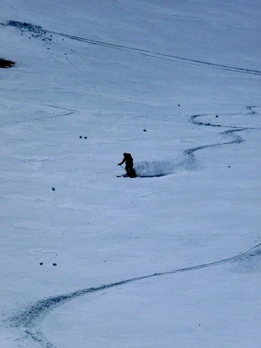
You only have to tell me something about technique once, and I’ll do anything I can to integrate the information. “Almost fall into your turn,” he said. On a short face I practiced, happily looking back at a few short and sharp twists in my line. We danced down the hill to the trees, finding a quiet meltout to gorge on snacks before heading up another gulley east of South Peak. With his Stelvios and Dynafit DNA’s, B practically ran up the hill, my 22# of boots and skis trudging along behind. It was a perfect blue run, long and untouched, where we both worked technique while hooting and hollering out of the shear joy of gliding down the slope.
[img]
http://farm5.static.flickr.com/4032/4549472215_801eded10b.jpg[/img]
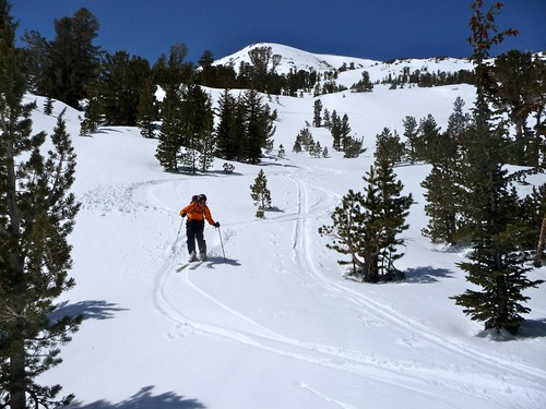
After much debate over a dinner of venison and couscous at the Moose Lodge, we planned a possible cruise up to University Peak on Sunday. But in the bright morning sunshine, sweat dripping sunscreen into our eyes, we opted instead for the cruise to Kearsarge Pass. Cresting above Heart Lake, we could see the long, southern slopes of Mt. Gould, the heart of which lay brown and bare about 200 feet above the pass. We rested and ate there, sandwiches of simple meat and cheese, and I gazed longingly into the west to the divide. Mt. Brewer’s east ridge was a solid and broad snow line diving to East Lake, the Vidette’s rising high above Bubb’s Creek. I could have sat and stared all day at the high peaks, snow glistening, blue sky enveloping all.
B took the camera with him as he swiveled and turned between the trees back to the plateau. “Right on!” shouted someone else making their way up to the pass. Shaking thoughts of a fall out of my head, I felt the snow under my skis, a little wet but yielding. Turning into the fall line, I let the corn harvest begin.
[img]
http://farm2.static.flickr.com/1028/4552928704_52a15e37b7.jpg[/img]
[img]
http://farm2.static.flickr.com/1274/4552929406_21423ba278.jpg[/img]
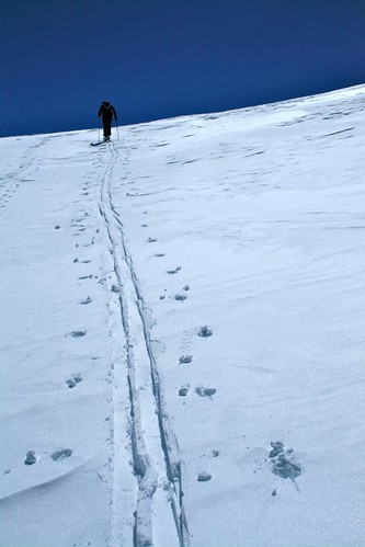
With a whoop and a holler, I was dancing again. Falling left and right, the skis catching my lean and the snow to form the squiggles I had always admired. The air blew clean and cool on my face and arms, I could smell the trees as they warmed and I flew by. Laughing, I pulled up to B and could hardly contain myself as we pushed off and down from there. There were a few sections of slop, spots where I would stop and think too hard but then force myself to make the turns again. In no time at all, we were back to Little Pothole Lake and traversing south of the drainage to come directly into the campground. One more series of dicey turns into heavy glop and we were down, headed back to the waiting trucks.
Two weekends, building skills, very different arenas. But, I think I’m getting the hang of it…
[img]
http://farm5.static.flickr.com/4007/4552300123_8abc9d2335.jpg[/img]
Pics from Red Rocks are
here, here, and
here. Pics from the
Virginia Lakes and
Kearsarge Pass. From the luckiest girl in the world: Climb Hard, Be Safe.
-L