|
|
Joined: Dec 2002
Posts: 415
Member
|
|
Member
Joined: Dec 2002
Posts: 415 |
That's an impressive picture!!
|
|
|
|
|
Joined: Jan 2003
Posts: 715
Member
|
|
Member
Joined: Jan 2003
Posts: 715 |
Steve, is this what you have in mind? I'm not sure if I labelled Lone Pine Peak and Mt. Muir correctly.
|
|
|
|
|
Joined: Aug 2003
Posts: 492
Member
|
|
Member
Joined: Aug 2003
Posts: 492 |
Hi Wayne, I think your label of Lone Pine Peak is actually the ridge leading up to Candlelight Peak & Irvine, but I do believe you have Mt. Muir labeled correctly though. A little help here Doug? 
|
|
|
|
|
|
Anonymous
Unregistered
|
|
Anonymous
Unregistered
|
Steve, is this what you have in mind? Yes, that's close, Wayne. Thank you. Only I was thinking of a picture from between 10 AM and 1 PM on a clear day. See this one from Joel Baldwin's archive. (only snag a full-size picture like you did with the one above.) And I am sure many people would like to see lines pointing to the approximate locations of the MR notch, Iceberg Lake, Upper Boy Scout and Lower Boy Scout Lakes.
|
|
|
|
|
Joined: Jan 2003
Posts: 715
Member
|
|
Member
Joined: Jan 2003
Posts: 715 |
Thanks, Mike. I'm still getting my peak-sighting program calibrated for the WebCam location.
Steve, it would be great if Dale Dalrymple with his expert photo skills could help out here, or BobR with all of his annotation skills.
|
|
|
|
|
Joined: Jan 2003
Posts: 389
Member
|
|
Member
Joined: Jan 2003
Posts: 389 |
With the web camera working and a storm in the Owens Valley today we can see the value of a bad weather backup system. Are there any plans for a bad weather backup like the Forest Service has long used in town? It works like this: Good weather: green line Bad weather: red line  Dale B. Dalrymple http://dbdimages.com
|
|
|
|
|
Joined: Jan 2003
Posts: 389
Member
|
|
Member
Joined: Jan 2003
Posts: 389 |
Steve, is this what you have in mind? Yes, that's close, Wayne. Thank you. Only I was thinking of a picture from between 10 AM and 1 PM on a clear day. See this one from Joel Baldwin's archive. (only snag a full-size picture like you did with the one above.) And I am sure many people would like to see lines pointing to the approximate locations of the MR notch, Iceberg Lake, Upper Boy Scout and Lower Boy Scout Lakes. I'd be happy to support this, but you'll have to share what you have in mind. Dale B. Dalrymple
|
|
|
|
|
Joined: Jun 2003
Posts: 5,435 Likes: 9
Member
|
|
Member
Joined: Jun 2003
Posts: 5,435 Likes: 9 |
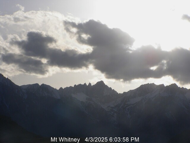
That gray photo up above gives me fair warning that I oughtn't bother heading to Lone Pine if my intention is to photograph the mountains. Leave it be.
|
|
|
|
|
|
Anonymous
Unregistered
|
|
Anonymous
Unregistered
|
Dayle: I've not seen the Forest Service's "Mt. Whitney on a cloudy day" sight. That's good!  As for what I had in mind... Just get one of the web am's sunny day pictures from mid day (I can do that part). Once we get a good picture, take it and add the identifications that Wayne has done, and then add a few more for all the identifiable spots, such as I named above. Once we get a good one, I'll store the image on the website, and put a link to it so those interested can view it. ...hope that makes sense.
|
|
|
|
|
Joined: Jan 2003
Posts: 389
Member
|
|
Member
Joined: Jan 2003
Posts: 389 |
That gray photo up above gives me fair warning that I oughtn't bother heading to Lone Pine if my intention is to photograph the mountains. Leave it be. Has the ranger station alternate view been a source of confusion for you during bad weather in the past? Dale B. Dalrymple http://dbdimages.com
|
|
|
|
|
Joined: Jan 2003
Posts: 715
Member
|
|
Member
Joined: Jan 2003
Posts: 715 |
Mike, I think I've calibrated my little peak-sighting program for the WebCam location. The peak I mislabelled as "Lone Pine Peak" is Peak 3581 on my topo map. And the peak peeking behind the north shoulder of Peak 3581 matches my calc for Mount Muir.
Dale, I would be happy to send my peak-sighting page to you, if that could help you annotate a photo for the WebCam. It also shows the locations for the Whitney Portal Store, the lakes, and some other places in the 10-degree panorama.
|
|
|
|
|
Joined: Apr 2008
Posts: 34
Member
|
|
Member
Joined: Apr 2008
Posts: 34 |
Thank you all who put in a lot of time and effort on the webcam. I can now sit and gaze at Whitney many times a day and it makes me feel, at least in a small way, that I am there!
|
|
|
|
|
Joined: Jun 2008
Posts: 38
Member
|
|
Member
Joined: Jun 2008
Posts: 38 |
Poster: ocn2mtz
Subject: Re: Whitney webcam photo
Thank you all who put in a lot of time and effort on the webcam. I can now sit and gaze at Whitney many times a day and it makes me feel, at least in a small way, that I am there!
For the thousands of us out here that feel just like ocn2mtz, a heartfelt thanks Doug, Steve, and others that have had a hand in making this happen.
|
|
|
|
|
Joined: Feb 2005
Posts: 66
Member
|
|
Member
Joined: Feb 2005
Posts: 66 |
|
|
|
|
|
|
Anonymous
Unregistered
|
|
Anonymous
Unregistered
|
Thanks O.A. and o2m and everyone else. It has been a lot of fun. I still have software tweaks and more plans to do, but at least we have the major part going. I'm enjoying seeing Doug's view just as much as everyone else! And a BIG thanks especially to Doug -- his building the Hostel with its vent in the attic set up for the camera, providing the computer and keeping it running, getting it connected to the internet, and of course, hosting this board. Doug, you probably don't realize how many people will be getting that warm-fuzzy fix every day out of this. Now... Daryl or Wayne, here's a great picture from this morning at 9 AM that I think is about as good as it can get. If you could copy it and add the annotations, it will make a nice addition for people to see. ...We can make it our "Whitney on a cloudy day" alternate picture.  ( Actual image location is: http://stevec.smugmug.com/photos/476201173_Ps6Qv-O.jpg ) 
|
|
|
|
|
Joined: Jan 2003
Posts: 389
Member
|
|
Member
Joined: Jan 2003
Posts: 389 |
SteveC
Picture copied
Dale B. Dalrymple
|
|
|
|
|
Joined: Sep 2004
Posts: 720
Member
|
|
Member
Joined: Sep 2004
Posts: 720 |
The picture still doesn't look right! Too many white in the photo! Need more tweaking!
Journey well...
|
|
|
|
|
Joined: Jun 2003
Posts: 949
Member
|
|
Member
Joined: Jun 2003
Posts: 949 |
The picture still doesn't look right! Too many white in the photo! Need more tweaking! I was thinking the white balance was out - "not enough" white - please add some more.
|
|
|
|
|