|
|
Joined: Aug 2006
Posts: 2,391
Member
|
|
Member
Joined: Aug 2006
Posts: 2,391 |
A quick ride from Onion Valley to Shepherd Pass: Robinson Lake: 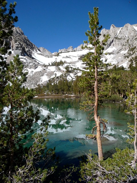 University Pass: 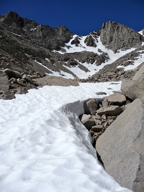 But first a quick jaunt up University Peak: 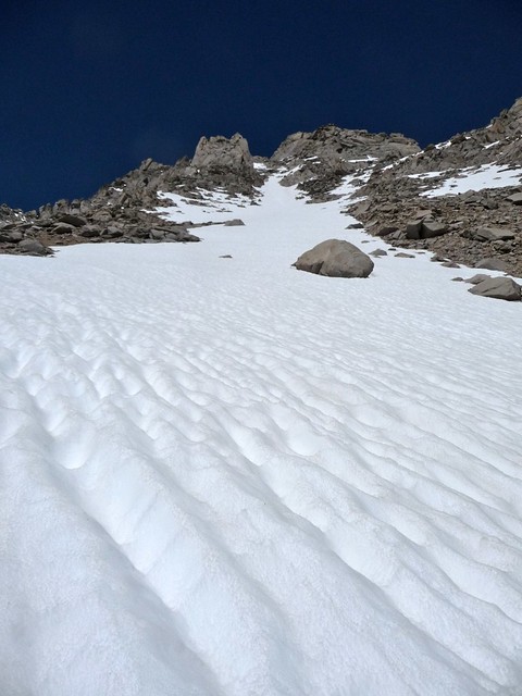 Only to be turned around by one patch of hard snow, since I had left my crampons back down at my pack and I didn't feel like farting around with it (argh, grumble): 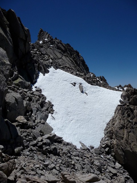 Oh well, back down to the pack and now trudge up to the top of Uni Pass: 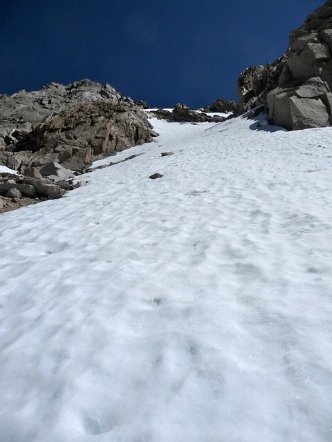 Jaw drop at the view into Center Basin: 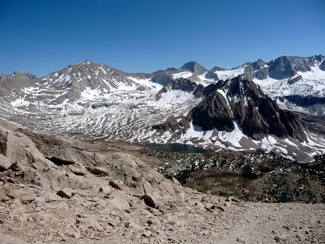 Check out the Forester Pass conditions from Uni Pass:  Drop straight into the chute, dart around to the slabs, drop back into the chute, look back up and wonder who in g-d's name decided going up and over this thing was a good idea (and the trench was NOT my doing, thank you): 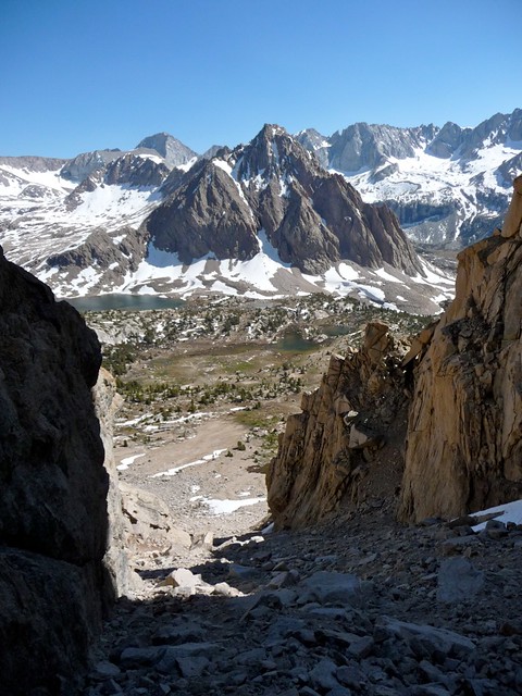 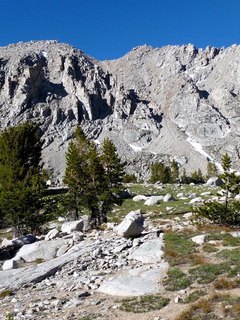 Break at the first tarn, down a Starschmucks VIA iced coffee (OK, they do SOMETHING right), and decide to head into the trees for the night, finding a horrible campsite along Bubbs Creek:  Sunset on Center reminding me of the glow on Spencer from EVO Lake last 4th (sigh): [img] http://farm5.static.flickr.com/4139/4765622308_aa8c655942_z.jpg[/img] Had the place to myself Friday night! Loaded up Saturday morning and started the long walk up to Forester (frost and ice on pretty much everything): [img] http://farm5.static.flickr.com/4122/4765346057_923475135e_z.jpg[/img] [img] http://farm5.static.flickr.com/4074/4765994306_f028d536b4_z.jpg[/img] [img] http://farm5.static.flickr.com/4076/4765995170_1b63444183_z.jpg[/img] [img] http://farm5.static.flickr.com/4099/4765997284_42a28252b2_z.jpg[/img] [img] http://farm5.static.flickr.com/4120/4765999736_471b461d59_z.jpg[/img] [img] http://farm5.static.flickr.com/4099/4765363117_b28b3bc0e9_z.jpg[/img] [img] http://farm5.static.flickr.com/4143/4765365257_bf1a954e99_z.jpg[/img] [img] http://farm5.static.flickr.com/4141/4766007066_27a01d0751_z.jpg[/img] Oh, man, about bloody time! [img] http://farm5.static.flickr.com/4078/4765369225_a6f2359bc6_z.jpg[/img] Views into Tyndall Creek (and a dry upper trail): [img] http://farm5.static.flickr.com/4120/4766009258_3b5e3a7608_z.jpg[/img] Wanted to bag some peaks, but the approach across the suncup ocean was overridden by the urge to take a nap: [img] http://farm5.static.flickr.com/4120/4765377633_6af79d2488_z.jpg[/img] OK, so down through Tyndall Basin, around the south end of Diamond Mesa, and back up to Shepherd Pass: [img] http://farm5.static.flickr.com/4082/4766025350_ca859fbefc_z.jpg[/img] [img] http://farm5.static.flickr.com/4077/4766031080_b82a0a2fc3_z.jpg[/img] [img] http://farm5.static.flickr.com/4141/4766036180_39a215a8a3_z.jpg[/img] Found another really crappy spot at the first tarn by the Pass  : [img] http://farm5.static.flickr.com/4141/4765408835_a68b6ceb64_z.jpg[/img] Had this tarn to myself all night (except for a certain lik2hik who thought walking across the frozen lake at 0100 would be fun... j/k Phil! Glad you made it down ok and hope my beacon didn't throw you off too much!). Woke up slow Sunday, waiting for the sun to crest Polychrome Peak and warm me and my neighbor before getting out of bed: [img] http://farm5.static.flickr.com/4134/4765648501_fdc2185a80_z.jpg[/img] People began to pour down the hill, the first being my friend Leti! [img] http://farm5.static.flickr.com/4080/4766287050_b6cdf2865b_z.jpg[/img] She and her friend Miguel had hit both Big Willie and Tyndall, and warned of the scores of people still up there. Lots of rocks flying in both areas, although Leti said the snow to the right of the north rib was in fine shape. Having climbed Tyndall before, I decided to instead pack up and head down with my friends. [img] http://farm5.static.flickr.com/4094/4765649797_b40a0574a5_z.jpg[/img] [img] http://farm5.static.flickr.com/4096/4766288646_6b4e3a9445_z.jpg[/img] And then I ran into my friend Kathy, who was coming up (apparently it's true, I can't be taken anywhere anymore!!)! [img] http://farm5.static.flickr.com/4097/4765650975_094d492641_z.jpg[/img] The rest of the rip down was uneventful and actually pleasant! Anvil Camp was blessedly free of bugs, there was a nice breeze, I soaked my head and shirt at the final creek before the dreaded sand hill, and even made it all the way up without stopping for rest! The Symmes Creek drainage is full of wild roses, and we three happily tumbled into the (ridiculously packed) parking lot at the trailhead around 1500 or so. After picking up the TOF back in OV, there was only one thing left to do: MOOSE BURGERS! [img] http://farm5.static.flickr.com/4114/4765682349_aea414e0a2_z.jpg[/img] Full set of pics are here, here, and here. From the luckiest girl in the world: Climb Hard, Be Safe. -L 
|
|
|
|
|
Joined: Jun 2005
Posts: 1,006
Member
|
|
Member
Joined: Jun 2005
Posts: 1,006 |
Great pictures Laura from some beautiful parts of the Sierra. Nice job and thanks (as always) for sharing!!
|
|
|
|
|
Joined: Mar 2003
Posts: 838
Member
|
|
Member
Joined: Mar 2003
Posts: 838 |
Beautiful pictures, Laura! I still can't get over how much snow is up there! ....finding a horrible campsite along Bubbs Creek:  Oh yah... It's tough  This camp site looks awfully familiar.... is this on the JMT at the Center basin Trail turn-off? I LOVE that site...it's always been one of our favorite!!! This picture, and those of Forester Pass (albeit much more snow-covered than I've ever hiked on) sure make me homesick to go back! Thanks for posting!!
"What we have done for ourselves alone dies with us; what we have done for others and the world remains and is immortal." Albert Pike
|
|
|
|
|
Joined: Aug 2006
Posts: 2,391
Member
|
|
Member
Joined: Aug 2006
Posts: 2,391 |
Spot-on, Rosie. I came down the Center Basin trail and saw the afternoon light glinting off the braided course of Bubbs. After skidding down to take pics, I was walking along the bank when I looked up and saw the bear box! It was such a perfect spot, no wind, in the trees, that it made for a perfect evening!! Paul has been bugging me about a trip into Center Basin, and I couldn't agree more. Gotta get back up in there!
-L
|
|
|
|
|
Joined: Oct 2008
Posts: 37
Member
|
|
Member
Joined: Oct 2008
Posts: 37 |
Great pictures Laura!!! You're very fortunate to be able to head into the mountains every weekend. I wouldn't worry about campsite selection. Unless alpine lakes, flowers and trees aren't your thing.  -Rudy
|
|
|
|
|
Joined: Jul 2007
Posts: 696
Member
|
|
Member
Joined: Jul 2007
Posts: 696 |
Stunning photos and fun TR as always. Wow, really, really nice. Looks like a total blast.
|
|
|
|
|
Joined: Jan 2003
Posts: 196
Member
|
|
Member
Joined: Jan 2003
Posts: 196 |
You sure know how to make a person feel bad. Thanks for posting your report. I enjoy reading everyone.
hiiker
|
|
|
|
|
Joined: Jan 2003
Posts: 968
Member
|
|
Member
Joined: Jan 2003
Posts: 968 |
Right - we're bitterly envious, yet we cannot look away.
We're moosochists.
|
|
|
|
|
Joined: Aug 2006
Posts: 2,391
Member
|
|
Member
Joined: Aug 2006
Posts: 2,391 |
I wouldn't worry about campsite selection. Unless alpine lakes, flowers and trees aren't your thing.  -Rudy Yeah, Rudy, you know how much I hate other living things... <snicker> Actually, the sand in that little nook by the tarn was wonderfully comfy. I would have slept like a rock had I not been awakened by footsteps on the snow... on the lake... (Phil, you better get on here and tell your story before I do...!!)
|
|
|
|
|
Joined: Oct 2005
Posts: 353
Member
|
|
Member
Joined: Oct 2005
Posts: 353 |
Laura, Totally awesome trip and photos, great stuff and thanks for sharing! Hmmmm……I just might re-consider and start lugging a 40+# pack into the backcountry ………………. nah, enough of that crazy talk…………….I’ll just enjoy the backcountry vicariously through your (and other’s) photo journals 
|
|
|
|
|
Joined: Aug 2006
Posts: 2,391
Member
|
|
Member
Joined: Aug 2006
Posts: 2,391 |
Laura, Totally awesome trip and photos, great stuff and thanks for sharing! Hmmmm……I just might re-consider and start lugging a 40+# pack into the backcountry ………………. nah, enough of that crazy talk…………….I’ll just enjoy the backcountry vicariously through your (and other’s) photo journals  Now, grahamcracker, even my 2-night pack is down to 30-35 lbs, depending on water and goodies! I'm sure you could handle that... Besides, there's always the promise of my cooking!  Hope to see you next month!!! 
|
|
|
|
|
Joined: Dec 2006
Posts: 904
Member
|
|
Member
Joined: Dec 2006
Posts: 904 |
First off, congrats on your 2-night pack down to 30-35 lbs!!! Your pix make me want to start doing the overnights again. There is nothing, absolutely nothing, like waking up in the wilderness on a beautiful morning: birds chirping, fresh espresso (I carry the mini e.maker on overnights) and a waterfront campsite always a plus. A well earned Forester Pass 'summit'. Gorgeous photos. Btw, if you want to truly go solo... you have to leave the eastern Sierra. 
|
|
|
|
|
Joined: Aug 2006
Posts: 2,391
Member
|
|
Member
Joined: Aug 2006
Posts: 2,391 |
Btw, if you want to truly go solo... you have to leave the eastern Sierra.  Silly, silly girl, MC. There are plenty of areas left that I could find solitude. I've barely scratched the surface! Now I just have to do something about finding a source of income that doesn't require me to work M-F... 
|
|
|
|
|
Joined: Jul 2008
Posts: 89
Member
|
|
Member
Joined: Jul 2008
Posts: 89 |
Right - we're bitterly envious, yet we cannot look away.
We're moosochists. Oh Miss Laura, guess I'm a moosochist too! Thanks for taking me along for the ride! Wishing I could be you on some weekends! Love you, the Mom....
|
|
|
|
|
Joined: Dec 2006
Posts: 904
Member
|
|
Member
Joined: Dec 2006
Posts: 904 |
Btw, if you want to truly go solo... you have to leave the eastern Sierra.  Silly, silly girl, MC. There are plenty of areas left that I could find solitude. I've barely scratched the surface! Now I just have to do something about finding a source of income that doesn't require me to work M-F...  Moose in one of the most remote areas of eastern Sierra. Moose fan hikes past and spots the Elusive Moose: 'may I have your Moosegraph please'? 
|
|
|
|
|
Joined: Aug 2006
Posts: 2,391
Member
|
|
Member
Joined: Aug 2006
Posts: 2,391 |
|
|
|
|
|
Joined: Dec 2006
Posts: 904
Member
|
|
Member
Joined: Dec 2006
Posts: 904 |
|
|
|
|
|
Joined: Jun 2004
Posts: 28
Member
|
|
Member
Joined: Jun 2004
Posts: 28 |
Hey Laura!
I've been out of town and just now read your T/R. Great trip!
[ j/k Phil! Glad you made it down ok and hope my beacon didn't throw you off too much ]
All kidding aside, I do so appreciate your "voice out of the darkness" informing me that I was standing ON the lake. Lot's of unintended things happened on the way out that night, but this would have been the last straw (literally?). An after-midnight swim in a frozen alpine lake was not on my list of things I hoped to do!
Thanks for watching my back.
I wasn't sure what to make of your light. It seemed to coincide with the waypoint I was trying to home in on. New policy: Blinking strobes at the top of major wilderness passes?? Didn't seem likely. Then the warning voice: Wow, that ranger is really dedicated.
Then - wait a minute. That's no ranger. That's laura! Complete with an orange vest and orange crocs - fresh out of her warm sleeping bag! Talk about wilderness spirit...
Thanks again,
Phil
|
|
|
|
|
Joined: Aug 2006
Posts: 2,391
Member
|
|
Member
Joined: Aug 2006
Posts: 2,391 |
All I know, Phil, is that I woke up to look at the stars, leaned over on my right elbow to stare up at Tyndall, when I saw an exquisitely bright star on the tip of the NW chute of the mountain. Then, the star moved. Crap, I thought, someone is up there trying to come down that chute in the dark! I remembered how Paul had put his strobe above camp when Ray and I were descending Feather a few weeks ago, and at the very least I wanted to person up there to know that there was someone else out there, if needed. I fell back to sleep thinking about hiking over the chute in the morning if I didn't hear anything during the night. When your footsteps woke me up, I'm glad you heard my voice and didn't see me in almost panic mode, ripping off my sleeping bag, throwing on my sweatshirt, and trying to figure out what I had that would help with extrication from the ice, preferably without me getting all wet, too!   When you looked up at me and said, "Is that you, Laura?" I almost keeled over. Next time, though, let me make you a cup of tea. 
|
|
|
|
|
Joined: Jun 2006
Posts: 167
Member
|
|
Member
Joined: Jun 2006
Posts: 167 |
Laura!
Thanks for your timely TR, as we plan to take OV-Charlotte lake-Forrester-crabtree-MW-WP starting 8/7. One q. On your Bubbs ck camping place - is this at the east bend of the ck north of FP.on JMT? If not where in center basin? As expected the most exciting TR & pics from you! Thanks! Appreciate your input.
Krishna
|
|
|
|
|

