|
|
Joined: Mar 2009
Posts: 79
Member
|
|
Member
Joined: Mar 2009
Posts: 79 |
I'll be doing another trip (4-5 days) to Whitney this summer (September) with a friend who hasn't been. I keep going back and forth on which route I want to take. It will either be Horseshoe Meadows to the Portal or Onion valley (via Kearsage Pass) to the Portal.
I was planning on doing the horseshoe meadows/portal trip again, but did a day hike recently with someone who said he much prefers the scenery on the Onion Valley route. Has anyone done one or both of these routes? Which do you prefer? I've been leaning toward the Onion Valley route because I haven't done it before, but I'm having trouble deciding.
|
|
|
|
|
Joined: Jun 2003
Posts: 5,428 Likes: 7
Member
|
|
Member
Joined: Jun 2003
Posts: 5,428 Likes: 7 |
If you need to stay on a well developed trail, I'd say OV to WP. If you can handle the X-C, HM to WP via the Miter Basin would get my vote.
|
|
|
|
|
Joined: Jan 2003
Posts: 2,446
Member
|
|
Member
Joined: Jan 2003
Posts: 2,446 |
I would exactly agree with Richard's choices.
|
|
|
|
|
Joined: Mar 2009
Posts: 79
Member
|
|
Member
Joined: Mar 2009
Posts: 79 |
What are some of your favorite places on the Onion Valley/Kearsage route? Good places to make camp for the night? I'll have to feel out my friend and see if he's comfortable going xc - didn't think about that originally. He doesn't backpack much, so maybe not.
|
|
|
|
|
Joined: Jun 2003
Posts: 5,428 Likes: 7
Member
|
|
Member
Joined: Jun 2003
Posts: 5,428 Likes: 7 |
You may not have a friend anymore if you take him from HM to WP X-C. It is tough, even with the exit to the PCT down the Crabtree Lakes drainage instead of the Dreaded Sand Hell.
Shin can give you a "X-C newbies" perspective on most of that terrain, although I took him in via Meysan and Mt. Irvine instead of the HM Trailhead.
I can't provide any advice on the camping along the JMT from OV. The few times I've done it have all been rushed. I picked a flat spot on the south side of Forester Pass that was an amazing place to be when the sun came up. Other than that, it's been Crabtree Meadows and LBSL when I did an Arctic Lake / NF exit rather than the usual Trail Crest exit.
|
|
|
|
|
Joined: Jan 2003
Posts: 2,446
Member
|
|
Member
Joined: Jan 2003
Posts: 2,446 |
What are some of your favorite places on the Onion Valley/Kearsage route? Good places to make camp for the night? I'll have to feel out my friend and see if he's comfortable going xc - didn't think about that originally. He doesn't backpack much, so maybe not. There are many, many places. Guidebooks for the PCT or JMT are helpful. Obviously where there is water. One place NOT to camp is in the area of the lake just north of Forester Pass. Barren, few flat spots, polluted. Better to be back in the woods, or over the top.
|
|
|
|
|
Joined: Mar 2003
Posts: 838
Member
|
|
Member
Joined: Mar 2003
Posts: 838 |
Some of my favorite places along the Onion Valley-to-Whitney section:
Charlotte Lake - it'll take you a little off the JMT your first day, but it's a beautiful little Lake. There are a few bear boxes.
Center Basin Trail Turn-off area - One of my very favorite on the JMT (this could be party due to sentimental reasons). It's a few miles north of Forester Pass - a really pretty area with Bubbs Creek running nearby. It is a large area (with a bear box), and you will most likely have other hikers there as well. If you'd rather keep going south a bit farther there are some nice small campsites to the right of the trail as you get close to the treeline. I agree with Ken, don't go above the timberline to camp.
Tyndall Creek: there are a lot of nice campsites spread out in this area, before and after your cross the creek. Bear boxes on both sides of the creek. It's a pretty area.
Wallace Creek:nice, but not very far from Tyndall Creek. There is a bear box there but only a few campsites. I've stopped to do laundry here a few times.
Guitar Lake: No bear box. It's comparable to Trail Camp in the number of camps set up there (and just about as awful), but it's a good location for going up and over Whitney the next day. I've never stayed at Hitchcock Lake, but I know of people who have. What IS fun about that area, though, is that everyone has been traveling a number of days to get there and excited about getting to Whitney the next day.
I really love this section of the JMT. Have fun, regardless of which trail you chose.
Rosie
"What we have done for ourselves alone dies with us; what we have done for others and the world remains and is immortal." Albert Pike
|
|
|
|
|
Joined: Dec 2002
Posts: 3,010 Likes: 3
Member
|
|
Member
Joined: Dec 2002
Posts: 3,010 Likes: 3 |
Hi A very hard question!! Rosie and Richard and the others picked the Jewels but let me add a seldom traveled route that covers much of the same ground . Take Baxter Pass into the JMT ,do the 60 Lakes trail around Rae Lakes area and stay one night in that basin before going over Glen Pass and as Ken says stay on the North side of Forrester ,making the next night some where around Wallace Drainage (watch for bug counts) but a mile up that canyon is a treasure. Fishing???? one of the best in the backcountry. No real hard days and make a trip out on the last day from Crabtree area.
Hint notice I didn't say anything about the Skyblue Lake area? That area should be a once in a lifetime trip for everyone that needs a special reward. Thanks Doug
|
|
|
|
|
Joined: Jun 2003
Posts: 5,428 Likes: 7
Member
|
|
Member
Joined: Jun 2003
Posts: 5,428 Likes: 7 |
OK, so I'm going to talk about a trip that's been on the agenda for years: - Over Kearsarge - Thru Center Basin - Maybe over the pass above Lake Helen of Troy; maybe down to the JMT - Wright Lakes area - Wallace/Wales Lakes area - NF exit or maybe over the pass above Wales Lake to the Arctic Lake area and then NF exit. I'll have to take a look at your suggestion and make some additional changes to this. Hint notice I didn't say anything about the Skyblue Lake area? That area should be a once in a lifetime trip for everyone that needs a special reward. Just like Whitney, I'll bet anyone who sees Sky Blue Lake up-close-and-personal will be back again. In the Miter Basin and the Wallace/Wales Lakes area, you really need to take the time to wander... and not just walk the path. The surprises you find will have you oooohing and aaaaaahing constantly.
|
|
|
|
|
Joined: Mar 2003
Posts: 838
Member
|
|
Member
Joined: Mar 2003
Posts: 838 |
OK, so I'm going to talk about a trip that's been on the agenda for years: - Over Kearsarge - Thru Center Basin - Maybe over the pass above Lake Helen of Troy; maybe down to the JMT - Wright Lakes area - Wallace/Wales Lakes area - NF exit or maybe over the pass above Wales Lake to the Arctic Lake area and then NF exit. I'll have to take a look at your suggestion and make some additional changes to this. Hint notice I didn't say anything about the Skyblue Lake area? That area should be a once in a lifetime trip for everyone that needs a special reward. Just like Whitney, I'll bet anyone who sees Sky Blue Lake up-close-and-personal will be back again. In the Miter Basin and the Wallace/Wales Lakes area, you really need to take the time to wander... and not just walk the path. The surprises you find will have you oooohing and aaaaaahing constantly. OK, you guys have me curious about this Sky Blue Lake! I'm going to have to check my maps when I get home.... I may have to tweak my schedule a bit!! 
"What we have done for ourselves alone dies with us; what we have done for others and the world remains and is immortal." Albert Pike
|
|
|
|
|
Joined: Dec 2002
Posts: 610
Member
|
|
Member
Joined: Dec 2002
Posts: 610 |
Hi
I was thinking about your comment that your partner was either a non-hiker type or barely familiar with hiking (not your words, mine).
First timers are usually not use to the elevation gain, 40 pound pack, dehydrated food and find sleeping an issue.
I have always worried about new hikers, or friends of new hikers taking on hikes that may caused them to literally not enjoy the hike because they are too tired or tried to accomplish too much or, are out of shape.
My suggestion to you is to stay on the trail, either from Cottonwood Pass or Kearsarge Pass and avoid the difficulties of either trying to cram too great a distance into each days hike or trying to go cross country.
I have done the Kearsrage Pass to Whitney well over a dozen times (taking my daughter and friends). I have taken the route most people have taken (JMT) and other routes off the beaten path, i.e., Center Basin over Junction Pass down to Upper Pothole and over Shepherd Pass, over Rockwell Pass to Wright Lakes and to Wallace Creek cross country. That route is especially difficult and dangerous on the south side.
My suggestion is to:
• Don’t count on bear boxes because if you don’t make it to the next bear box, there may be issues.
• Keep the mileage to a manageable distance
• Try and make camp early to relax and enjoy the scenery
Suggested itinerary:
Kearsrage Lakes (about 7 miles). Take the low trail….
Center Basin (about 7 or 8 miles)
Tyndall Creek (about 10 miles and a 13,100 foot Pass)
Crabtree Meadows (10 miles)
Guitar Lake (3 miles)
Option: the tarns (beautiful campsites, rocky, much like Trail Camp in that there are numerous rock walled campsites) about Guitar, about ¾ of a mile farther, BUT I recommend this only if the snow year is normal or above since there is a stream there. It does go dry if a poor snow year. The beauty of this campsite is that you are only about an hour and half from the junction of the trail coming over from the Portal where you leave your pack.
Final night, either Trail Camp, Outpost Camp or hike out to the Portal
Just my two cents..... have a good and safe trip, no matter the route you decide on.
Paul
|
|
|
|
|
Joined: Mar 2003
Posts: 838
Member
|
|
Member
Joined: Mar 2003
Posts: 838 |
Well, I couldn't find Sky Blue Lake on my maps, so I did a search on it... I couldn't find a great map on-line but it looks like its south of Crabtree Meadow(?)... but I couldn't tell how far. I don't know if that's going to work for me this summer... something I'll put on my list.
My suggestion is to:
• Don’t count on bear boxes because if you don’t make it to the next bear box, there may be issues.
• Keep the mileage to a manageable distance
• Try and make camp early to relax and enjoy the scenery
Paul
... totally agree on all points! I've only stayed at Kearsarge Lakes twice (the first Lake, I think) - last time was 2001... there was a lot of bear activity.
"What we have done for ourselves alone dies with us; what we have done for others and the world remains and is immortal." Albert Pike
|
|
|
|
|
Joined: Dec 2002
Posts: 610
Member
|
|
Member
Joined: Dec 2002
Posts: 610 |
HI ALL,
BEAR BOX LOCATIONS
• Charlotte & Kearsarge Lakes
Charlotte Lake Kearsarge Lakes (3)
• Bubbs Creek Trail
Vidette Meadow (2) the upper Vidette Meadows bear box is broken (2011)
John Muir Trail/Center Basin Trail
• Tyndall/Crabtree
Tyndall Creek/John Muir Trail
Tyndall Creek Frog Ponds  about a mile from the JMT and creek crossing
Wallace Creek/John Muir Trail
Crabtree Ranger Station
Lower Crabtree Meadow
|
|
|
|
|
Joined: Mar 2009
Posts: 79
Member
|
|
Member
Joined: Mar 2009
Posts: 79 |
Rosabella, This link on Google Maps should give you an idea where Sky Blue Lake is. It's southeast of Crabtree Meadow. Thanks for all the replies. I should probably add more info. So there will be four of us. Three of us are regular hikers/backpackers. My one friend isn't, but he is still usually a strong hiker. He did avy gulch with me on Shasta without any problems. That being said, I don't want to turn this into a torture trip for him, which is why I'm iffy on the x/c route. If we did it, we'd go up by Sky Blue Lake and over to Crabtree. Paul, The route you laid out is pretty similar to the one I was considering. The only difference is I was considering going from Center Basin to Tyndal or Wright Creek and from there to the tarns. Both routes sound great, I guess I just need to really decide if the miter basin cross country will be too much or not. He's adventurous, so it might be fun to just go for it.
Last edited by Jeff81; 02/07/12 02:45 AM.
|
|
|
|
|
Joined: Mar 2003
Posts: 838
Member
|
|
Member
Joined: Mar 2003
Posts: 838 |
Thanks for the link Jeff. That was kinda where I was figuring it to be. While I was doing the search I did come across some pictures of it... really pretty!
Rosie
"What we have done for ourselves alone dies with us; what we have done for others and the world remains and is immortal." Albert Pike
|
|
|
|
|
Joined: Dec 2002
Posts: 610
Member
|
|
Member
Joined: Dec 2002
Posts: 610 |
Hey Jeff,
The three times that I have gone over Junction Pass (all solo), I must say that this past year was quite an eye opener this past year, 2011. I was shocked to see that the trail (from the previous 2 hikes, 1995 and 1996) was non-existent down the south side…. The trail from Center Basin to the pass was still in great condition (very visible) considering that it has not been maintained since 1932.
Once the trail starts down from the south side of the pass, the slope (the angle (slope greater than 35 degrees), which includes loose scree, loose rocks that makes for a dangerous decent). If you decide to go for that route, please feel free to email so that I can give you a more detail description if you desire (and some pictures… sorry, I don’t post pictures to a photo sharing site…. too lazy) of the route from the pass down to Shepherd Pass trail.
What I like about the route is that it does deposit you right near the base of Tyndall and Williamson. At that point (at the pass…..you could climb Tyndall or Williamson, head over Rockwell Pass to Wright Lakes, OR….. head down to Tyndall Creek… about 5 miles of gently sloping trail which makes for 3 mph pace).
Paul
|
|
|
|
|
Joined: Aug 2006
Posts: 2,391
Member
|
|
Member
Joined: Aug 2006
Posts: 2,391 |
Why not possibly extend the trip by a day or two and come out at Horseshoe Meadow? You could bag Whitney as a side trip from either Crabtree or Guitar, or haul the packs up to Trail Crest, then drop down through Miter Basin, Soldier Lakes, up up and out Army Pass (whichever you prefer/conditions warrant). The Miter Basin is indeed gorgeous, but there's a LOT of sand and I would think the descent would be a lot more appealing than hauling a big pack up and out. Your friend(s) could garner a good amount of XC experience without turning it into a slogfest. The dreaded Sand Hill (Trail Crest is just out of frame to the right):   Miter Basin from just north of Soldier Lakes:    Now, as for camping, you have your pick pretty much all the way from Kearsarge, which itself is a great way to start the trip: gradual trail, ~2500 vertical from the parking lot, one of the best pass-views around, and downhill for a llloooonnngg ways into Vidette Meadows. If you take the low trail, you'll just have to keep your eyes peeled as you pass between Kearsarge and Bullfrog Lakes, as there was a lot of avy activity last year and it's pretty much a mess (although mostly salvaged by hard-working crews!). There are bear-boxes at Vidette Meadows, then again a few miles upriver (Bubbs Creek, now) at the Center Basin cutoff. There may be a cairn marking the left (east) turn into Center, and the trail was in pretty good shape last time I was there. Great lakes up in that area, for sure. I think camping here along Bubbs was one of my fave spots, and despite it being July 4th weekend last time I was there, I had it to myself. 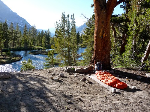 As for higher up, I'm not sure what Ken meant by "polluted", since the only think I saw polluting the area was a huge concentration of Polemonium! The area is definitely exposed, and you'd probably have to hunt for tent spaces, but I've had plenty of friends camp there. Personally, hitting the pass in the middle of the night under a full moon is perhaps one of the best ways to cross it (depending on the south-face snow field, of course...).  The Tyndall Basin south of Forester is stunning, plenty of camping and water running everywhere. Enjoy your planning. You can't go wrong! -L 
|
|
|
|
|
Joined: Mar 2003
Posts: 838
Member
|
|
Member
Joined: Mar 2003
Posts: 838 |
LOVE, LOVE, LOVE this campsite! I think I've stayed here at least six times! I really liked the idea of going over Forester Pass by moonlight, but the chart shows only about half a moon on that day for me. However, I'll have a full moon the day that I go over Mather Pass... might be a GREAT way to go up the Golden Staircase!
"What we have done for ourselves alone dies with us; what we have done for others and the world remains and is immortal." Albert Pike
|
|
|
|
|
Joined: Aug 2006
Posts: 2,391
Member
|
|
Member
Joined: Aug 2006
Posts: 2,391 |
Rosie: my parents sent me this. A new twist on hiking the JMT?
|
|
|
|
|
Joined: Jul 2007
Posts: 696
Member
|
|
Member
Joined: Jul 2007
Posts: 696 |
Darn, now I have to hike the JMT twice (day and night). That looks awesome.
|
|
|
|
|


