
***First off, I want to extend a thank you to Doug(s), Earlene, and all the folks at the Portal Store/Campground, and the posters on this board. This is an extremely valuable resource that helps many get to the top of this crazy mountain and who knows, might even save some lives.***
Now here's my extremely long trip report/tips:
My single regret from hiking Whitney this week is that I'll never get to do it for the first time again...

As they say, the third time's a charm; after being turned down two years in a row, we finally got our permit this year for August 31. I originally wanted an overnight permit for two of us, but my last slot on the application was for any dayhike in August, and that's what we got.
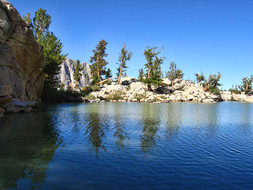
We arrived in the Portal Monday around noon, set up camp, and quickly took a hike up to Lone Pine Lake. I had seen pictures, but had no clue how peaceful and serene this place would be. We had lunch here, took a nap on the rocks, and just relaxed. Headed back down to camp in time to grab a few things from the store and cook dinner before nightfall.
Right after cleaning up, we had our first visitor. A big guy, I'd guess somewhere around 350lbs, he came up, sniffed the locker, checked what we had on the table, and sauntered back into the forest.
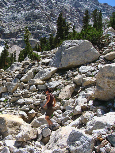
Tip #1: What you hear about bears in the Portal is no joke, they're everywhere. Just keep your stuff within arms’ reach or locked up AT ALL TIMES, they're not aggressive but they also aren't shy.The following morning, we headed up the Meysan Lakes Trail. A little disappointed that we couldn't find Little Meysan Lake (any tips? I still have no clue where it is, there just seemed to be a meadow where it should have been...), and since our big hike was the following morning we decided to turn back just shy of Peanut Lake. Awesome scenery up here and we only come across one or two other hikers, so if you want to avoid the crowds, give it a shot. Warm down at the start of the trail, though, and not much shade.
 Tip #2: Acclimate!
I'm convinced that these two hikes made all the difference in the world for our Whitney hike. These combined with sleeping at the Portal for two nights left us with absolutely NO issues from altitude whatsoever. We were expecting at least
some AMS-like symptoms, but nope. On to the big hike...
We drove up to the trailhead at 3:00am and were on the trial by 3:15am. Having never hiked in the dark, I was a little apprehensive but it ended up being quite enjoyable. We flew up the first couple miles to the Lone Pine Lake junction, no issues with the water crossings, and continued to make good time up the unfamiliar sections to Outpost Camp.
Tip #3: Bring a map.There are
very few issues finding the trail even if you're only paying half attention, but there are a couple points where you might get turned around. We ran into a group stalled at the Outpost Camp junction having no idea which way to go. They didn't have a map, and it isn't clearly marked which way to turn. Pulled out my map, pointed to the right, and in 5 seconds they were on their way. Bring a map. Not only will these little junctions pose no obstacle, but they also help you identify landmarks and whatnot along the way.
Tip #4: THERE ARE A LOT OF SWITCHBACKS HOLY COW!!!! (not really a tip)I thought I had researched the trail from top to bottom, but I was surprised at just how many switchbacks there are. All you ever hear about are the 97, but there are
easily twice that, probably close to 250 one-way (has anybody actually counted?). There's nothing physically demanding about them, but if you're like me and let them get to you from time to time, just keep hiking and focus on the brilliant scenery around you. It feels like you're getting nowhere, but eventually, you'll get past them. Trust me.
So on we went, past Bighorn Park and its easily negotiable water crossing(s), through Outpost Camp and its simple junction, past Mirror Lake glowing eerily under the starlight, and up to the Whitebark Stump section. This is where we started seeing the first signs of dawn, and this is where I’ll pull aside for a second.
While researching the hike, I often stumbled across arguments on dayhiking vs backpacking Mt Whitney. Some say backpacking is the only way to go, as dayhiking requires you to hike partially in the dark and you miss the beauty of the mountain (not true). Some say that dayhikers are only there to complete some kind of test of endurance and aren’t respecting the trail (not true, and even if it were, who cares?).
The truth is, it’s exactly what you make of it. There’s no right or wrong, and to be honest I initially wanted to backpack it and stay a night at trail camp, slightly disappointed that we got a mere day permit, but looking back I wouldn’t change a thing. First, you miss
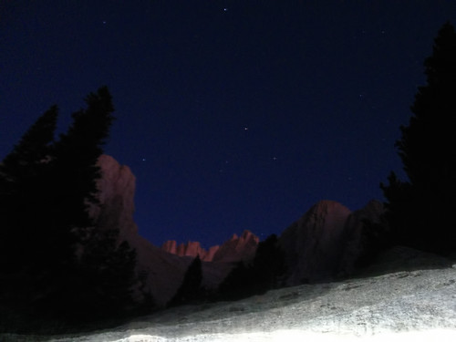
nothing on the trail; your senses adjust and are attuned in a completely different way. There’s no right way to enjoy the forest, it’s there whether the sun is up or not. Even in the dark, we took our time, sauntered, made sure to look around us and enjoy the experience, and I absolutely loved hiking beneath the Milky Way. There’s something magical about that…
Bottom line:
Tip #5: Don’t be discouraged if you didn’t get the date/permit you wanted. This mountain will see to it that you have an unforgettable experience.
After gawking in awe at the surreal landscape in front of us, granite ridges aglow with a new day, while still beneath a sky filled with countless stars, we continued. Eventually, the dawn was sufficient to shutoff our headlamps and continue, and when the sun finally came up over the Inyo Mountains we found ourselves at Trailside Meadow.
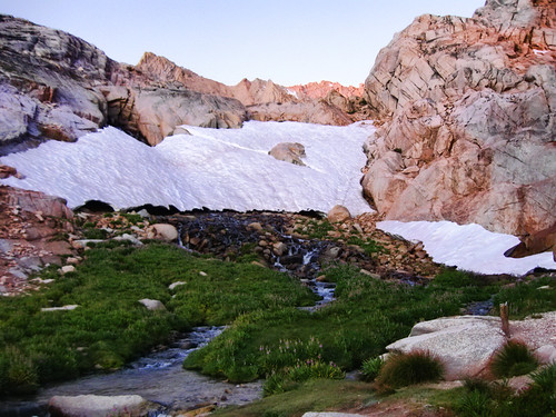
I’m glad this area is protected from camping, as it seems incredibly delicate but also stands out as one of my favorite sections of the trail. You’re also approaching 12,000 feet here, so I hope you put the work in in the months leading up to your hike, otherwise you’ll start feeling it. Speaking of that…
Tip #6: Prepare!This hike is no joke. We prepared for months, hiking Mt Baldy several times, including the North Backbone route, several other multi-peak long mileage hikes, Clouds Rest from Happy Isles in Yosemite, etc. Be in the best shape of your life. Hydrate the week leading up to it, eat well, rest. You went through all the trouble of getting the permit and making your way to the Portal. This is one of the few factors you can control.
The stretch from Trailside Meadow up to Trail Camp seemed a lot longer than it should have… Probably because our first lengthy break would be at Trail Camp. We made it there without incident and were surprised to find the small lake covered in a thin sheet of ice around the edges. Needless to say, it was cold.
Tip #7: Layers, layers, layers.As with all of my other tips, this one shouldn’t be news. It was much, much colder in full sunlight at Trail Camp than it was at 3:00am down at the trailhead. The weather is hard to predict, so don’t skimp on the clothing. The extra 2 or 3 lbs and added bulk are worth it once you get up to 12,500+. It’s cold. Very cold.
Had a few snacks and rested here for about 30 min. It helped a lot to reenergize before the 97 switchbacks. To be honest, they weren’t that bad at all. It’s along this stretch that you really start seeing the summit and the Smithsonian Hut. Some might say that the switchbacks are too gently graded, but I disagree… This being my first time up above 12,500, I appreciated the ease of the slope even if it adds to the distance.
Plus, there was still plenty of ice on the slopes. Easy to cross, but if you’re not looking for it, it could be an unpleasant slip. One rock was completely covered in icicles, and this being the last day in August, I can only assume that ice on the switchbacks is a year-round concern.
But at the end of the day, the philosophy of one foot in front of the other holds true. You’ll make it. It went by much quicker than I thought it would.
Once you hit Trail Crest, you’ll have a whole new set of things to look at to keep your mind off of the hike.
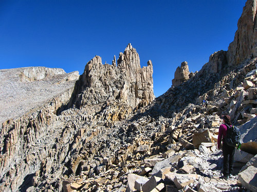 Tip #8: The Stretch from Trail Crest to the Summit is Relentless
At 13,600 you’ll be inclined to think, “Only 900 vertical feet to go!” Wrong. For one, you dip down something like 500’ to the JMT junction (not really that much, but it feels like it), so there's really more gain than it seems. And at this elevation, any gain is exponentially harder. We were lucky. We did our acclimatizing and it paid off big time. No ill effects whatsoever, but that’s not to say it was easy. I would stop every 40 yards or so for a break. The views are stunning, not only of the Great Western Divide and Sequoia, but of the until-now hidden west face of Whitney and the needles.
Not much to say here, to be honest. You just have to push through it. There are some sections with tricky footing and extremely intimidating drops to the west, and of course there are the windows, but the trail is wide enough to safely get by.
The weather was perfect for us. Textbook perfect. But it wouldn’t be fair to not mention the following:
Tip #9: Lightning is an Extremely Serious Concern on the Sierra CrestIf there are
any signs of thunderstorms in the area (dark clouds, buzzing, static electricity on your arms, etc) turn back and descend immediately. It’s not worth it. The mountain will be there next year. In fact, it’s still growing, so it’ll be even more impressive next time.

We encountered a large snowfield just below the summit, easily crossed without any kind of gear other than poles. And the summit push is actually pretty easy. Chances are, your excitement will pull you up that last couple hundred yards with very little effort.
Once you reach the summit, the relief is indescribable. You probably won’t be alone, other hikers and marmots will be there to greet you and steal your food. Soak in the views, (carefully) stand on the rocks and realize you’re higher than anyone in the lower
49 states. And then reality sinks in… you still have 11 miles to go.
Tip #9: Read as Many Trip Reports/Websites as PossibleAs I’ve already mentioned, we got extremely lucky with the weather. It literally could not have been better. In all likelihood, you will not be as lucky. Read other reports, particularly in the days/weeks leading up to your hike. Go back through archives and read reports from past years in the same time of year as you’ll be climbing. We didn’t have to use much of the information we read, but we were prepared. We had our layers, were prepared to turn back if the weather turned ugly, had our iodine tablets for filtering water (ended up not needing them), had waaaay more food than we needed, etc.
I don’t have much to add on the descent, it was straightforward and
extremely long.
Key Advice: It can’t be said enough times. The goal for this hike is not the summit, it’s your car parked at the Portal. You
MUST get back there. This hike is 22 miles, not 11.
Other things:Vitalyte – they sell this stuff at the Portal Store and also at stores like REI, Adventure 16, etc. It works, and it’s delicious. Basically Gatorade without the excessive sugar.
Pace – go at your own pace. Too fast or too slow and you won't make it. The best advice I've seen in this regard is to go at a pace that you can sustain for an hour without stopping.
Enjoy the Mountain – In many ways, this is the most important part. You've read all the warnings, done all your homework, you're in the best shape of your life....
Remember that you’re hiking Mt Whitney. For most of us, this is a rare opportunity. Whether you make it or not, enjoy the unique surroundings. As I was sitting on the summit, another hiker finished and shouted “I’m on top of Mt Whitney!!!” and I sat there thinking to myself, “Holy ****, I’m on Mt Whitney too!”
A whooole lot more photos here:
http://www.flickr.com/photos/wattifoto/sets/72157627586948694/ Hopefully somebody can get something out of this (extremely long) post like I did prior to my first time. See you at the top!


