|
|
Joined: Jun 2012
Posts: 26
Member
|
|
Member
Joined: Jun 2012
Posts: 26 |
I climbed both Langley & Whitney during a 3 day hike the 1st week of August. From Langley, I descended the steep scree chute below the Major General to upper Soldier & spent the night @ Sky Blue. The next day I went over Crabtree pass and continued down the lakes drainage to the RS, then continued up the JMT to Guitar for night #2. The last day I went up to Whitney and down for a burger. IMO, the scree makes Langley a bit of slog, and of course the lack of any discernible trail amongst the hundreds of runners fanning out across the plateau forces you to use your route finding skills. I wasted a few minutes on the western most rocks, but quickly realized the way to go was to come around the back end via the scree & sand. Of course, then you have to go straight up even more scree & sand to the summit, but that's another story. (One of will power.) While Langley is a slog, coming down the chute was way more challenging. There were a few points where I had to drop my pack over some small edges and climb down, but overall it wasn't not too bad. I don't know if I was tired the next day, but I thought the toughest part of the entire hike was coming down the Crabtree watershed. While the south-side of the pass is easy, the north-side is a different story. It's not really steep per se, and there isn't any exposure, but I thought the combination of talus, boulders & ramps provided enough herky-jerky that I could never get a groove going. It continues this way all along the 1st lake, and you really can't get going until a small use trail appears after the 2nd. After that, it's a long way down to the RS, and then of course you have to go back up to Guitar. Whitney is Whitney - nice trail, steep in parts, hard rocks, lots of people. I think the hardest part is going back down the 97 switchbacks, but that's just me.  Whitney from Langely 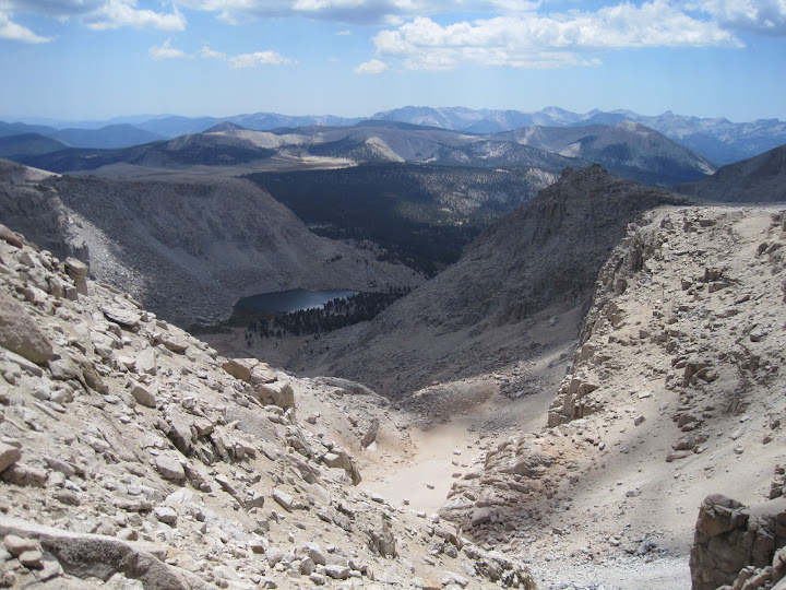 Chute below Mjr Gen down to USL 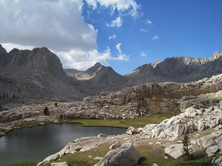 Miter basin through the notch 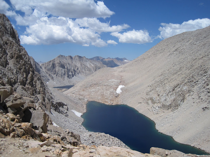 Crabree lakes from pass 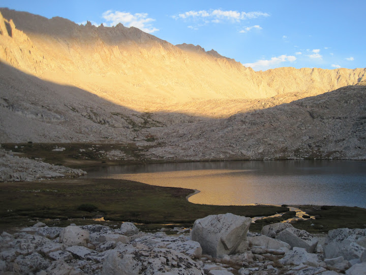 Last light @ Trail crest  Langley from Whitney
|
|
|
|
|
Joined: Dec 2002
Posts: 985
Member
|
|
Member
Joined: Dec 2002
Posts: 985 |
Odd, but White Mountain has been the hardest dayhike I've done yet.
|
|
|
|
|
Joined: Aug 2006
Posts: 2,391
Member
|
|
Member
Joined: Aug 2006
Posts: 2,391 |
You should try it with snow.
|
|
|
|
|
Joined: Dec 2002
Posts: 985
Member
|
|
Member
Joined: Dec 2002
Posts: 985 |
I thought I did... 
|
|
|
|
|
Joined: Dec 2002
Posts: 587 Likes: 1
Member
|
|
Member
Joined: Dec 2002
Posts: 587 Likes: 1 |
Snerf,
Thanks for the nice TR and photos.
You noted that after reaching the summit of Mt Langley you descended to Upper Soldier Lake by the chute next to the Major General and that this chute (shown in your photo) was somewhat of a challenge. Much easier terrain would have been encountered if you had taken the next chute directly to the south (beginning about a half mile south from where you started to descend to Upper Soldier Lake).This latter chute has a sandy, but well defined use trail and one could ride a horse down it. It is shown of older maps of the area, such the one inserted in Starr's Guide to the John Muir Trail and the High Sierra Region (Sierra Club books, 1934).
What an awesome region of the High Sierra!
Thanks again,
Jim F
|
|
|
|
|
Joined: Aug 2006
Posts: 2,391
Member
|
|
Member
Joined: Aug 2006
Posts: 2,391 |
I thought I did... Oh, that's right, that last 100ft you had to cross must've been tough. Broke a sweat, did you?
|
|
|
|
|
Joined: Dec 2002
Posts: 985
Member
|
|
Member
Joined: Dec 2002
Posts: 985 |
I thought I did... Oh, that's right, that last 100ft you had to cross must've been tough. Broke a sweat, did you? Yep, but still held on to my sense of humor and humility, unlike some...
|
|
|
|
|
Joined: Jun 2012
Posts: 26
Member
|
|
Member
Joined: Jun 2012
Posts: 26 |
Much easier terrain would have been encountered if you had taken the next chute directly to the south (beginning about a half mile south from where you started to descend to Upper Soldier Lake). Yes, I knew about the 'standard' approach and had taken a look on the way up. I had studied my topo map beforehand, so I had an inkling the second chute was steeper. As I was descending Langley, I could tell some others had taken that route. I took another look @ my map, and as I could see the whole way down, I decided to go for it. Challenging is perhaps the wrong word - I only meant it in context of relative difficulty vs ascending Langley. At no time was it ever more difficult than class 2. For an actual, honest-to-god, don't blow it or this could be very bad feeling, I came down Shepherd the 1st week of June. Some nice person (Richard P?) had stomped in some boot tracks, but it still was kind of airy:  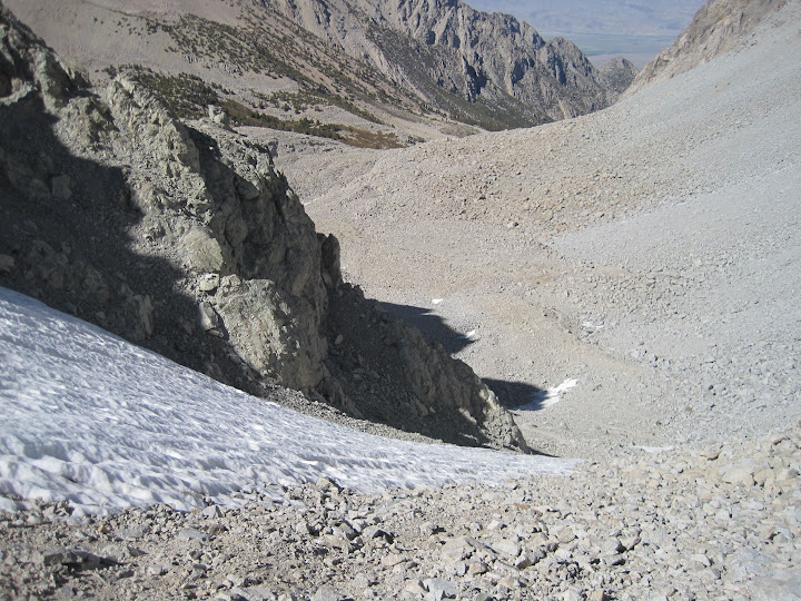 Afterward, I saw Richard P in the back of Doug's kitchen. He was kind of surprised I recognized him, but I know he's a legend. It took me 2 days (1 night below Forester) to copy his Shepherd-OV day hike, in reverse no less (much easier). I almost felt like asking him for his autograph. LOL
Last edited by Snerf; 09/14/12 12:01 PM.
|
|
|
|
|
Joined: Apr 2010
Posts: 46
Member
|
|
Member
Joined: Apr 2010
Posts: 46 |
Akichow and CatB thanks for the beta ..
Funny what we remember as hikers/climbers.
I would climb Whitney and Langley few times a yr when i was living Bishop 2000-2004 by various routes ..
This Oct I'm coming out to do Langley and Whitney with my wife by NAP and MT, which I've never done!!
Expecting long days of walking cuz I'm not really in mountain shape.
Its my favorite part of the Sierra for sure with its gorgeous compressed alpine granite and open vistas.. Runner up would be Granite Park/Royce Lakes area.
|
|
|
|
|
Joined: Aug 2006
Posts: 2,391
Member
|
|
Member
Joined: Aug 2006
Posts: 2,391 |
Yep, but still held on to my sense of humor and humility, unlike some...
Oh, that's right it's been a while, sorry. Next time I'll use the little winky-smiley-face for you.  There ya go. All better.
|
|
|
|
|
Joined: Dec 2002
Posts: 985
Member
|
|
Member
Joined: Dec 2002
Posts: 985 |
I decided to take another look at Langley last Sunday to compare, and I can say---without a doubt---the way we went was a lot harder than the Whitney main trail, but then again, your mileage may vary: http://citycg.com/nonsite/outdoor_pics/nab/index.html  (And no, Doug. Again, no bolts. All clean and free...)
|
|
|
|
|
Joined: Apr 2010
Posts: 708
Member
|
|
Member
Joined: Apr 2010
Posts: 708 |
If you rotate that picture 90 degrees clockwise, and pretend that the scale is 1 inch equals 1 foot, it almost looks doable.
|
|
|
|
|
Joined: Mar 2012
Posts: 69
Member
|
|
Member
Joined: Mar 2012
Posts: 69 |
Langley tougher than Whitney? OK, since my friend & I went up Langley on Sun I’m weighing in on this. Yes & No. Depends on which route you take. We didn’t know any better & went up what was probably the worst route possible. Straight up one of those chutes on the right when looking at it from the top of the passes. My friend scrambled right up that thing like he’d been doing all his life. It was very scary for me since I don’t have rock climbing skills. But I guess I do now. We got onto the summit & the first thing I said is, ‘I’m NOT going down that way!’. On the summit there were some folks who kindly let us accompany them on the descent so we could see which way we SHOULD HAVE come up. There were cairns everywhere showing the way. DUH! So the moral of the story is, plot your path to the left of the chutes & look for the cairns (?). Yea, OK, the sand & scree are pretty bad but you just deal with it. It’s fun on the way down tho. If we had gone up that way then I would say it was easier than Whitney. But I’m calling it more difficult because of the scrambling route we took. Also the initial plan was to take OAP but we got advice from the ranger station & the mountain shop in LP to use NAP so we did. But if we do this again we will probably use OAP, depending on conditions of course. So Thank You! to Anna & her husband (sorry didn’t get your name) for showing us the way down.
|
|
|
|
|
Joined: Apr 2007
Posts: 22
Member
|
|
Member
Joined: Apr 2007
Posts: 22 |
Yep, that last mile or so up the granite sand is a real work out. I've hiked it three times.
"Teach a kid to fish, and they will never forget you"
|
|
|
|
|
Joined: Apr 2007
Posts: 139
Member
|
|
Member
Joined: Apr 2007
Posts: 139 |
|
|
|
|
|


