Mt. Whitney Webcam 1

Webcam 1 Legend
Mt. Whitney Webcam 2

Webcam 2 Legend
Mt. Whitney Timelapse
Owens Valley North

Owens Valley North Legend
Owens Valley South

Owens Valley South Legend
Previous Thread
Next Thread
Print Thread
Page 36 of 66 1 2 34 35 36 37 38 65 66
Shin #98140 07/06/14 04:21 PM
Joined: May 2004
Posts: 538
Member
Member

Joined: May 2004
Posts: 538
Frank A. pointed this sign out to me about 200 yards off the Summit
at the time I didn't ever remember seeing it but later that day I remember seeing it maybe 5 years ago, what I didn't know was that Bob R. was part of the rescue team..

So Shin once again I missed you by minutes on the Summit, Dan(621st summit)was coming down the east side and I asked him if he saw you up there(we knew your car was in the village)and he said your were still up there when he left..missed you again

Nice day on Summit,cookies of the day were cranberry,dark chocolate chip,macadamia nut oatmeal cookies

mark
pictures here Baldy


rick #98142 07/06/14 09:28 PM
Joined: Dec 2003
Posts: 447
Member
Member

Joined: Dec 2003
Posts: 447
10 yrs, seems like this happened yesterday,Sad.
Did you hike RR to the summit when you saw the marker?
Dave

Joined: Oct 2009
Posts: 520
BaldyMaster
Member
BaldyMaster
Member

Joined: Oct 2009
Posts: 520
Hi Mark,
I decided to hike up Bear canyon trail to get more workout. I didn't meet or see anyone on the trail till the summit except a friendly cat just above the church. It was a bit warmer in the switchbacks. I met Yeti(Jeff S.) and his friends on the trail.

Miguel F. set the fastest time, 1:13,from Manker to the summit.
He was running like a bighorn sheep. He is an amazing athlete.

As to the memorial plate, I have seen another memorial plate on a tree at 8800 feet elevation area on Ski hut trail.

Looking forward to seeing you all next time.
You guys are still looking very young.
Shin

Joined: Jan 2009
Posts: 120
Member
Member

Joined: Jan 2009
Posts: 120
What's a part Vampire doing hiking during the day? That is the question.

Never noticed the memorial sign before, is that on register ridge?

Did anyone here know that person? I didn't start hiking until the mid-fall of that same year.

Hope everyone had a fun filled fourth.

smile

Joined: May 2004
Posts: 538
Member
Member

Joined: May 2004
Posts: 538
Dave-Patrick...We took R/R up to summit on the way down - ski hut trail,not far down from the summit just off the trail (yards off the trail).

I took this picture of Louise and Cathy on purpose, I was standing next to the tree in case someone asked to show how close to the trail it is.


As you can see in the background the Eastern end slope to get to the lip of the Main Bowl..

Happy Climbing Patrick smile

mark


rick #98151 07/08/14 03:59 AM
Joined: Dec 2003
Posts: 447
Member
Member

Joined: Dec 2003
Posts: 447
What I remember, he was an experienced mountaineer, family man and succumbed to an accident on the ice. There was another accident around the same time with alot of SAR out for awhile.

Joined: Oct 2011
Posts: 6
Member
Member

Joined: Oct 2011
Posts: 6

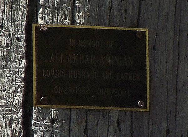
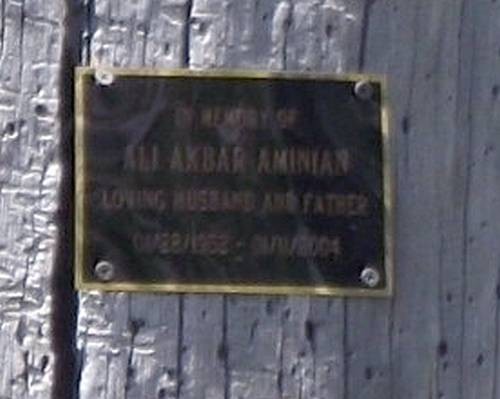
Here is Ali's other memorial plaque, just a short ways below the Ski Hut, on the left side of the trail. It is about 40 ft. to left, as you near the final switchback stretch below the hut.

Also two close-up pics (zoomed in camera) on two other days, neither of which came out so well.


Ten years have flown too quickly. I met Ali thru the Sierra Club, but did not have a chance to hike with him. He was president of the Calif. Mountaineering Club at that time.

I spoke a tiny bit of Farsi with him, and with even our limited interaction he was friendly and warm, and brimming with enthusiasm for the mountains. Memorable enough for me that five or six years later when I heard the name of the missing hiker, I knew it was him. BeGrims.... May he rest in peace.

Here's part of the LA Times article I saved in '04--it may still be available/archived online:

"Body of Missing Newbury Park Hiker Is Found on Mt. Baldy

*Ali Aminian, an experienced climber, slipped on an icy trail and fell more than 500 feet down a slope, authorities say

By Lance Pugmire and Holly Wolcott, Times Staff Writers

The body of a Newbury Park hiker who had been missing for three days was found Wednesday on Mt. Baldy, where he apparently had slipped on a narrow, icy trail and fallen more than 500 feet down a slope.

Ali Aminian, 51, was an experienced hiker and Sierra Club member who had been president of the California Mountaineering Club in 1998.

"One of the things he said was that if he had to die, he wanted to die climbing in the mountains," said Jilaa Aminian, a 21-year-old sociology major at UCLA and Aminian's oldest child. "I just hope that he didn't suffer."

Aminian was hiking alone Sunday, en route to the 10,064-foot peak of Mt. Baldy, when he encountered what rescuers described as hard, frozen ice conditions. He fell near the 8,990-foot elevation marker on Bear Flats Trail, hitting small pine trees as he plummeted and stopping under a small pine that obscured his body from searchers, a rescue official said.

One of four rescue dogs picked up a scent at sunset Tuesday. About 11:30 a.m. the next day, volunteers from the China Lake Mountain Rescue Group found the body. The terrain was so icy that the rescuers' metal shoe spikes "barely stuck to the slope," said volunteer Tom Roseman. "I'm sure he just slipped and couldn't stop himself until he hit the bottom." Aminian was wearing basic hiking boots, Roseman said.

A Los Angeles County sheriff's helicopter lowered a hoist to recover the body."


stay safe,
see ya out there,
arocknoid

PS Ridgeline, the other hiker missing at that time was Charles Koh, whose body was later found in Goode Canyon.

Joined: Mar 2012
Posts: 69
Member
Member

Joined: Mar 2012
Posts: 69
I am (was?) scheduled for a group hike this Sat on Baldy. There's been alot of unconfirmed information about flood damage bandied about but this was the latest I received from others in the group.
If anyone has gone up there & seen trail conditions firsthand maybe you can report back to this board...

<<11:04 AM
Danny, I just got an email (see below) from Michael, one of the LA Backpackers organizers, regarding the cancellation of his scheduled backpacking trip to Baldy this Saturday... What do you think?
----
Well, I'm sorry to say that I just learned that the trails up Baldy are washed out from the mudslides/rain storms. I had called a ranger station on Monday and was told that there was some debris on the trails but they were still accessible. But I now understand that it's far more serious than that. The Visitors Centre at the base of Baldy was destroyed by mudslides so it is closed indefinitely. So I called a number of ranger stations and was told by a few different rangers that they have not been able to clear the trails, nor will they by Saturday. And, while they haven't closed the trails, I'm not comfortable leading anyone into a situation this hazardous. I am hoping to do the hike in the Fall and look forward to joining in on others.>>

CatB #98323 08/06/14 11:33 PM
Joined: Jun 2003
Posts: 5,428
Likes: 7
Member
Member

Joined: Jun 2003
Posts: 5,428
Likes: 7
Weekly Update: 8/5/2014

Thanks for all the support to all of you who reached out to our community after Sunday's flash floods. The damage was fairly light to the upper mountain with minimal wash outs that will be repaired today. The residents of Goat Hill and other specific areas in the village continue to pick up the peices today where several homes were comprimized by mud and debris.

With the rain behind us we will be operating this coming weekend for Moonlight Hikes with live music Friday August 8th with Ron Ely and Saturday night, visiting us from San Fransisco on their Southern California tour, the Three Times Bad Band.

The Beatunes performance Saturday night was nothing short of spectacular. If you missed the show be sure and check these guys out or send us a note letting us know you would like to see them back at the Notch again soon.

See you on the mountain!

Last edited by Richard P.; 08/06/14 11:34 PM. Reason: quit hanging out with people who overreact...
rick #98333 08/09/14 05:40 PM
Joined: Nov 2009
Posts: 5
Member
Member

Joined: Nov 2009
Posts: 5
My wife and I hiked Baldy yesterday via the Hut trail. The Baldy Rd has been cleared along with the shoulders graded in the Manker Flats area. The trail to the hut is in good shape, but maybe a little rockier from all the rain water. Crossing the Bowl the trail has another erosion channel across it. Climbing out of the bowl through the trees and on to the summit, the trail has a lot of erosion and is now a lot rockier. Some of this will smooth out once enough hikers make their way up and down the peak. Hikers who are not familiar with the route may have difficulty finding their way until enough foot prints make the trail more obvious.

Joined: May 2004
Posts: 538
Member
Member

Joined: May 2004
Posts: 538
Frank Des and I took R/R Saturday at 2:30p because of to many people coming down main trail. We headed to West Baldy to spend the night and enjoy the Full Moon, then in morning hike over to the ski lift for breakfast..Very crowded around Baldy summit, and some SOB knocked down the main wind break again..

Trails were good all the way up and over to ski lift some gulleys made good foot steps for us, the deepest gully we came across was 6"

37deg. in morning, with a strong cup of coffee
Hey... Just Another Bitchen Day On Baldy

mark
pictures here

Saturday Sunset


Sunday Sunrise


Sunrise On Baldy


Joined: Oct 2004
Posts: 119
Member
Member

Joined: Oct 2004
Posts: 119
Great conditions for a moonlight overnight, not much wind at night and a beautiful morning, everybody we saw was grinning.


Mark and the Mountains:


Frank A
"If you want to go fast, go alone. If you want to go far, go together"

African Proverb
http://www.flickr.com/photos/asbufra/
Joined: Oct 2005
Posts: 353
Member
Member

Joined: Oct 2005
Posts: 353
Nice moon shots Mark, thanks for sharing cool

Here's some more photos......
Lots of new ruts all over Baldy


This guy seems to enjoy the summit crowds


New rocky crop-circle near the summit


If you’d like to help


Looks like they removed a bunch of dump truck loads of dirt


Lots of work being done behind the ranger station


Joined: Jul 2007
Posts: 696
Member
Member

Joined: Jul 2007
Posts: 696
Mark, did you take those photos with the Hubble? Wow!

Frank/Graham, also nice pics, thanks for sharing.

Those ruts will make nice glissade tracks. smile

Joined: Sep 2006
Posts: 444
Member
Member

Joined: Sep 2006
Posts: 444
Great pictures! Thanks!

It looks like you're using a Soto Windmaster stove. I just got one and used it in Humphreys Basin for 4 days of rain, hail, and constant wind and it always worked like a charm. I don't know how long the ignitor will last but it will still be a great stove if eventually I have to use a match to get it going.

Joined: Aug 2007
Posts: 51
Member
Member

Joined: Aug 2007
Posts: 51
I have that stove, too. Only used it for a few days total so far, but I've been very happy with it. Haven't used a Jetboil, but it seems comparable. Boils water amazingly fast!

Joined: May 2004
Posts: 538
Member
Member

Joined: May 2004
Posts: 538
Burt..maybe Hiking Jim can answer this(i might have asked him this before but forgot his answer)On the ignitor at elevation I'll push it in and it will click once(not firing) and then all it does is just push in without any response so I have to go to my windproof matches, this is what happened on Baldy last weekend and I'll be using it again Saturday night on Langley..

Lower elevation it works fine..

mark

Joined: Sep 2006
Posts: 444
Member
Member

Joined: Sep 2006
Posts: 444
Mark, I was using my Soto stove at Desolation Lake which is higher than the summit of Baldy and didn't have that problem. It didn't always ignite the first time but always did eventually.

rick #98416 08/20/14 04:37 PM
Joined: Aug 2011
Posts: 245
Member
Member

Joined: Aug 2011
Posts: 245
How is Register Ridge after the rain storms a couple of weeks ago? I want to try it for the first time Saturday and am wondering if I'll have any difficulties following it. I will have a GPS track of the trail.

I have a friend that would like to go with us. Problem is, his wife is due to have their 3rd child in a couple weeks. Is there cell reception on the mountain? I've been up Baldy a few times, but have never tried my phone.

Joined: Oct 2004
Posts: 119
Member
Member

Joined: Oct 2004
Posts: 119
Register Ridge is in fine shape, probably fared better than the Ski Hut trail. There is a rut or two, nothing that is difficult.


It seems my phone seldom works on the summit of Baldy, but I know phone service on Baldy Summit is possible, but most of the trails on the way have no service.


Frank A
"If you want to go fast, go alone. If you want to go far, go together"

African Proverb
http://www.flickr.com/photos/asbufra/
Page 36 of 66 1 2 34 35 36 37 38 65 66

Moderated by  Bob R, Doug Sr 

Link Copied to Clipboard
Mt. Whitney Weather Links


White Mountain/
Barcroft Station

Elev 12,410’

Upper Tyndall Creek
Elev 11,441’

Crabtree Meadows
Elev 10,700’

Cottonwood Lakes
Elev 10,196’

Lone Pine
Elev. 3,727’

Hunter Mountain
Elev. 6,880’

Death Valley/
Furnace Creek

Elev. -193’

Powered by UBB.threads™ PHP Forum Software 8.0.0
(Release build 20240826)
Responsive Width:

PHP: 7.4.33 Page Time: 0.113s Queries: 54 (0.061s) Memory: 0.8170 MB (Peak: 0.9496 MB) Data Comp: Off Server Time: 2025-03-16 13:43:05 UTC
Valid HTML 5 and Valid CSS