Hi Burt, It gets dark early these days, with the wind it must have been a cold night. News: Published: Nov. 17, 2014 Updated: 9:57 p.m
MOUNT BALDY: Hikers rescued after cold night on mountain Two lost hikers spent a cold night on Mount Baldy before being rescued unharmed, say San Bernardino County sheriff's officials.
Friends triggered the Sunday night search for 34-year-old Kendy Cruz of Reseda and 33-year-old Genesis Ilada of Buena Park after the pair made a 6 p.m. call to say they were lost.
Sheriff's helicopter pilot Ryan Conner and flight officer Ryan Peppler used night vision goggles to find the hikers on a steep ledge at the 7,700-foot level of San Antonio Canyon, sheriff's officials said in a written statement.
"Due to the steep terrain, the tall trees and the strong winds in the canyon, the crew was unable to rescue the ... hikers," according to the statement. "Ground teams from West Valley Search and Rescue made an extremely difficult hike to the victims and stayed with them."
Early Monday morning, the hikers were hoisted aboard a sheriff's rescue helicopter operated by pilot Al Daniel, crew chief Mike Ells and paramedic Eric Sherwin, who flew them to deputies waiting at the Cow Canyon Saddle.
Frank A "If you want to go fast, go alone. If you want to go far, go together"
It was a perfect day on Baldy. Thanks! The view from the summit rated about a 9.8. San Clemente Island was clearly visible, not just a smear in the haze. You could see ships in the bay and harbor. Even the San Gorgonio Pass was clear and I could see details on the 2 peaks.
The frosting on the turkey had to be spotting what I think had to be Olancha Peak. I'm basing that on the fact that it was due north of the summit of Baldy (allowing for a little error because I haven't corrected the declension on my compass for over a year) and it was a perfect pyramidal shape. So, unless someone corrects me I'm sticking with Olancha.
I have to admit, when I started visualizing the bearings, I said "wait a minute, how can White mountain be North of Baldy, when it is East of Whitney??" Living much farther north in California, it is easy to forget that the further south you go (in this state) the further EAST the location is. I should have immediately remembered this from flying (where you learn that Reno, Nv is WEST of major destinatios in the southern regions). Thanks for posting this information.
This makes me nostalgic for the "Is it possible to see Half Dome from Turlock" great debate (yes you can,as proven by our dearly departed friend, Wayne....who used to help me with my math problems)
Last edited by Bee; 11/28/1408:52 AM. Reason: waxing nostagic on the heavy side
The body betrays and the weather conspires, hopefully, not on the same day.
Thanks Dale. One clarification: I did set the declension on my compass when I bought it. I just haven't changed it to bring it up to date for over a year. So the error is about 1 degree, not 12.
Math is math and trumps my vision. But Olancha is a pretty distinctive shape and is more isolated than Telescope. (I thought I also identified the Pannamints yesterday without picking out specific peaks.)
Incidentally, on last Saturday I camped at Mahogany Flats. It was really cold and I didn't sleep well. Sunday I started up the Telescope Peak trail but I felt lousy and knew almost from the beginning I wasn't going to summit. Monday I did summit Wildrose Peak which is a really pleasant hike.
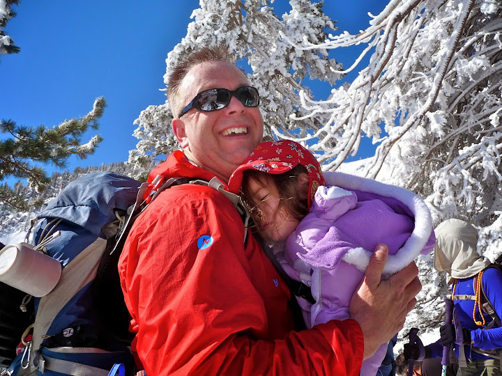
I was on Baldy yesterday. Lovely day. Very nice in the sun, a bit cool in the shade. I was with my daughter, age 5, who likes to climb on everything, so I didn't summit.
We just went to the ski hut. It was a rather proud moment for me as a hiking daddy; this was the first time my daughter did it all under her own power. This was at least her 4th time to the ski hut (that I can remember). Hiking all on her own is quite a difference from her first time when I carried her 100% of the way.
The hut was open, so we got to go in.
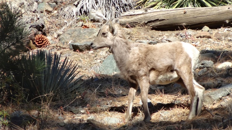
We saw some wild animals.
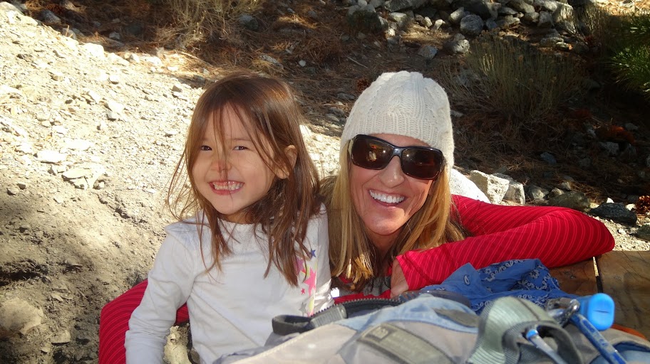
We saw some friends.
And in some cases "wild" and "friends" were one and the same.
Five miles RT, about 2000' gain/loss. Not bad for a five year old (and her old man father!). GPS Track plotted on a topo
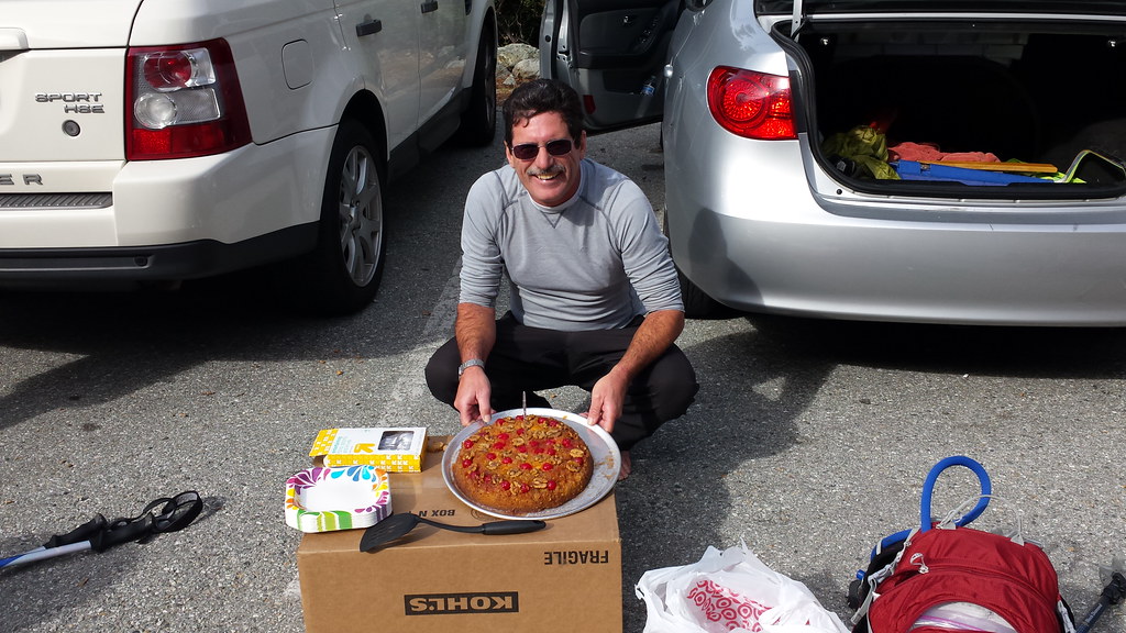
Oh, and yes, we did fit in some stove testing. Of course. lol
Thanks, Burt. We have fun, and it's a learning experience for her. I want her to see and experience the wider world. Something outside Hello Kitty videos and the like. Something a bit more real.
Since so many of us follow what is happen down here in the southland on this thread I'll post this here -
If anyone left a pair of boots at the Manker Flats Trail Head contact me I have them. They could have been left Wednesday, Thursday or Friday morning. Pass the word on other boards so we can get them back to the owner.
According to my friend, Martin Parson, who hiked Mt. Baldy, Harwood, West Baldy via Register ridge trail today, there wasn't any snow or ice on entire mountains except small amount of snow left on north facing slope of Mt. Harwood from Monday. This recent rain storm didn't leave any new snow at all.
It looks like we can put away crampons, ice axe, and micro into the storage again.
Hiked up Baldy on Saturday and despite being told there was no snow up there I was still surprised after that storm during the week to see no snow at all, not even on the North facing ridges. Although, on the plus side the moisture had dampened down the trail somewhat which made going downhill much easier.
Bumped into Shin on the way up so we joined forces to tag the summit(for Shin it was the second time that day) and then over to West Baldy, met a lot of good people on another beautiful blue sky day.
The photos that I've seen of nearby San Gorgonio Mountain show only light snow -- and Gorgonio is ~1,500 feet higher than Baldy. It just wasn't a particularly cold storm, and there just wasn't a lot of snow.
Went up the Register Ridge route yesterday (Monday). A beautiful day to hike Baldy. I carried a jacket but used it on top as a seat cushion while I ate lunch and had a good conversation with a man from Canada. He and I were the only people up there although 3 men were nearing the summit as I headed down the Ski Hut trail.
But trash! Someone in the past day or two had left orange peel, candy wrappers, and kleenex on the Ridge Route. I would have thought that by the time someone knew about the RR they would also know about leave no trace rules.
Even worse, a week ago when I went up there were a bunch of Sierra Club fliers in the register box. This week the fliers were scattered down the hillside where you make the first big turn after the register. I don't see how they could have blown there. It looks like someone deliberately threw them down the hill. I thought about going down to pick them up but (1) I was tired and (2) it should be done by 2 people, one to belay the one going down the hill. I hope someone from the SC reads this and goes to pick up the trash.
Conditions on Baldy? Best in two years. Last time (Shin 300 hike) the snow was gone for the season within a week. This year who knows but more snow forecast this week. Photos from Saturday 12-13-14:
Nice pictures James I like to get up there right after a snow fall but this weekend couldn't do that so Sunday was the next best.. We were short on time so we just went up to Kellys camp it was just nice to be in snow again, the scenery was awesome even if not all that much snow fell. After the hike we enjoyed Pineapple Upside Down Cake that I made.
So Doug this is the second time that I have posted pictures and can't enlarge them anymore then they are, is this something on my side or are you doing something different.
Hi Mark I adjusted the setting ,looks like it sized your photos as always some great shots, Doing odd jobs the last 6 weeks finishing the ranch project and Doug's backyard, closing the Portal and Earlene had a long list for the house down south ,thought I might sneak in a Baldy trip yesterday but needed to do final work on the house so I could paint before the storm. Alabama Hills project is active now will do a walk with Dave Kirk Thursday to find the best best option of the bottom of the NRT into town, once we thought we had just the old mine road over LP Hill but over the years I found the 1900's trail just outside of town and that links into a trail that goes to the Arch Trail very scenic and will still provide multi use. Ao This maybe a winter hike soon! Tell your dad Hi as always.
I had a fun hike on Register Ridge yesterday morning before rushing off to work.
I started hiking around 3:45, pushed it up the ridge as far as I could before sunrise (~8300 ft), snapped some photos, then headed down. On the descent, I met a gentleman named Martin that was attempting his 248th summit. He thanked me for breaking the trail for him and we exchanged contact info.
The trail was hard to follow in the dark, but the snow was decent up to around 7500', then the postholing began. I tried my snowshoes at that point - the trail is awfully steep there, but it was better than sinking in.
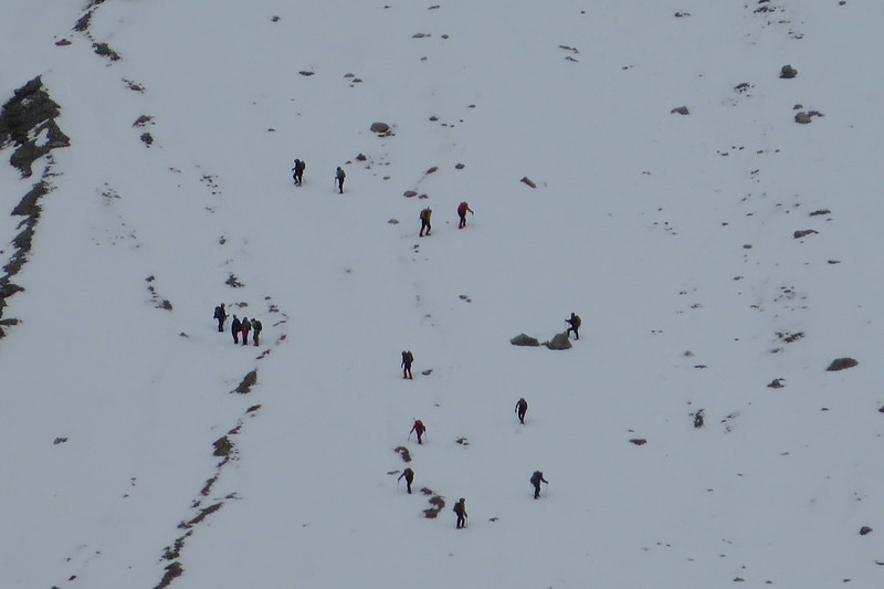
Trail condition 12/19/2014 Mt. Baldy road is free of snow or ice. Manker flat had snow and parking area along the road was a bit tight because of the snow. The trail from the fire road to ski hut had snow entire way today. There was 1-2 feet of snow from Ski hut to the summit. Some section was a bit deeper. The snow wasn't consolidated, yet. It was soft and powdery. It is a good idea to use winter boots, micro spikes, gators, ice ax, poles with snow baskets, and snowshoes. According to Patrick M. and Dave G., the snow level of the bowl was knee deep. You can hike up and glissading down the bowl.
Today, Patrick M., Sam P., Dave G., Ryan D., and I had a fun hike. We met Kathy W., Dez. and Mark A. on the trail.
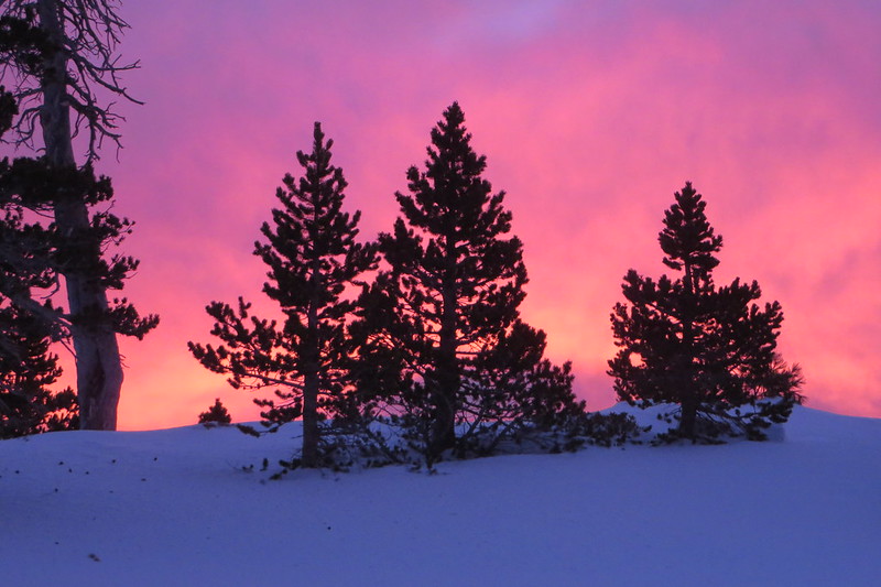
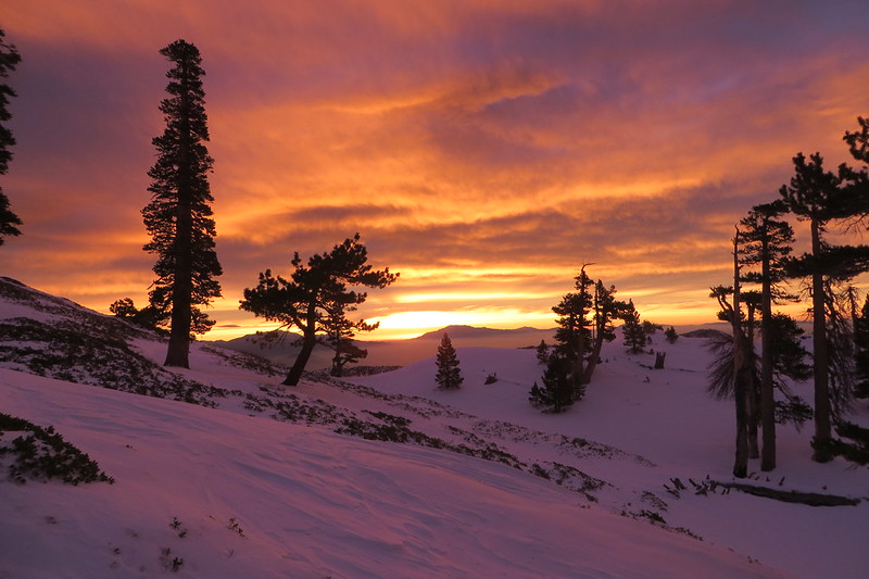
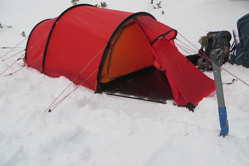
So Des and I had a plan to spend the night at West Baldy but got a late start so we stayed Below Baldy on top of the Main Bowl where you start your last climb to summit. We had a nice hot dinner and snacks to make for a good night sleep. The wind Friday night was off and on but didn't bother us in the tent cause Des has this bomb shelter with enough guy lines that nothing is going to move it. Saturday morning we headed for the summit as the sun was coming up(a damn nice sunrise), got back to the tent had breakfast and headed down cause we knew the herd was coming up..stayed warm the whole time, my feet got cold once so I'm getting those booties for the outside.
Looked like it was going to snow a few times but didn't
As Shin said those are the conditions
Temps: Friday evening 20deg in the morning in the tent 35 outside 20 summit 18 breakfast in the tent 28