|
|
Joined: Aug 2011
Posts: 245
Member
|
|
Member
Joined: Aug 2011
Posts: 245 |
|
|
|
|
|
Joined: Sep 2006
Posts: 444
Member
|
|
Member
Joined: Sep 2006
Posts: 444 |
But it's raining in downtown LA right now so probably snowing at higher elevations.
|
|
|
|
|
Joined: Aug 2011
Posts: 245
Member
|
|
Member
Joined: Aug 2011
Posts: 245 |
But it's raining in downtown LA right now so probably snowing at higher elevations. I hope you're right! It seems that they keep scaling back the snowfall forecast everytime I look. Maybe I should stop looking? 
|
|
|
|
|
Joined: May 2004
Posts: 538
Member
|
|
Member
Joined: May 2004
Posts: 538 |
|
|
|
|
|
Joined: Jun 2005
Posts: 1,006
Member
|
|
Member
Joined: Jun 2005
Posts: 1,006 |
Seeing all your black & white images reminds me of looking at old school photos from my father and his friends taken in the 30s, 40s, & 50s  . Thanks for posting the pix!
|
|
|
|
|
Joined: Aug 2011
Posts: 245
Member
|
|
Member
Joined: Aug 2011
Posts: 245 |
A couple more from yesterday (clicking brings you to the full gallery):


|
|
|
|
|
Joined: Jun 2005
Posts: 1,006
Member
|
|
Member
Joined: Jun 2005
Posts: 1,006 |
Great shots 63Chevyll. Looks beautiful... one of my favorite parts of So Cal
|
|
|
|
|
Joined: Jul 2010
Posts: 150
Member
|
|
Member
Joined: Jul 2010
Posts: 150 |
TR 3/7/15... annual birthday hike today.. not much snow below the hut.. below the Rock Garden solid snow trail.. used YaxCables. The trail was solid as it was frozen all the way to the top. Hit the top about 9:30... about 10 people including a group that came up the Bear Flats trail (is it officially open?) they said it was in good shape most of the washout damage had been filled in. It was very windy so only spent about 20 min on top. Heading down, almost from just below the summit it was a train of people heading up. All kinds of config. shorts tennis shoes... to some looking like they were ready for an Arctic exp. and some with skis I quit counting at 100. and I wasn't even back to the last steep section of trees heading to the hut. The trail to the hut was just as crowded... Glad I got an early start. Hope everyone gets down safely. Still my favorite local mountain. Rick
|
|
|
|
|
Joined: May 2004
Posts: 538
Member
|
|
Member
Joined: May 2004
Posts: 538 |
So since I couldn't to Baldy during the week I went up early this morning, hit the trail at 1:45a and did a full moon hike up the main bowl to meet Desiree at her camp below the summit. BTW: Rick was that you that we met on your way to the summit at Des camp It was his BD hike also. mark pictures here  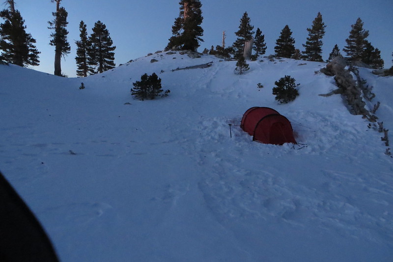 ALL THE DUCKS IN A ROW 
|
|
|
|
|
Joined: Jul 2010
Posts: 150
Member
|
|
Member
Joined: Jul 2010
Posts: 150 |
Hi Mark,
Yes that was I. I hadn't seen you since that breakfast with you and Shin about 3 yrs ago.. After I headed on up I was wondering if that was you. You pictures are great. Hopefully I'll see you again before
so much time passes. Happy Hiking.. Rick
|
|
|
|
|
Joined: Sep 2006
Posts: 444
Member
|
|
Member
Joined: Sep 2006
Posts: 444 |
BUMP
I did hike the Ski Hut trail yesterday. Nothing special to report. But i was surprised that this thread had disappeared off the topics list so i'm bumping it back to life.
Burt
|
|
|
|
|
Joined: Aug 2014
Posts: 89
Member
|
|
Member
Joined: Aug 2014
Posts: 89 |
Did the Ski Hut / Baldy / West Baldy / Devil's Backbone yesterday. Beautiful weather, no snow except for tiny patches that no one will walk through anyway. Brought the spikes not knowing what to expect, ended up in shorts and short sleeves, got a little toasty on the way down!
|
|
|
|
|
Joined: Oct 2009
Posts: 520
BaldyMaster Member
|
|
BaldyMaster Member
Joined: Oct 2009
Posts: 520 |
Rick G. spotted a carcass of young brown bear less than 1/5 of mile beyond the trout pond on Mt. Baldy road yesterday morning around 6:45 am.
The bear didn't have any apparent scar or any bleeding from the body.
It looked very fresh. There were paper plate and some food stuff scattered in the middle of the road.
I have seen many bears in this mountains but this was the first time to see a dead one. There is a "Bear Crossing" sign about 100 yards beyond the bear carcass.
We reported the incident of bear to the ranger station after our hike but the ranger wasn't clear about which agency, either National Forest department or Animal Control department, was responsible for taking care of the bear carcass.
We were sad about this young bear.
Photos are in my member album link.
Shin
|
|
|
|
|
Joined: Aug 2014
Posts: 89
Member
|
|
Member
Joined: Aug 2014
Posts: 89 |
Ski Hut ,Baldy, West Baldy, Harwood, Devil's backbone yesterday. Beautiful day!
I met Shin and Rick on the way up and when they were on their way down; someday I will hike that fast!
I had lots of energy, record summit time, was able to touch all 3 peaks, wanted more!
Shin and Rick, nice to meet and get to know you guys, Randy nice to see you again! Hopefully I will see you and more people up there this summer.
|
|
|
|
|
Joined: Oct 2009
Posts: 520
BaldyMaster Member
|
|
BaldyMaster Member
Joined: Oct 2009
Posts: 520 |
Hi Halfdomer Homer,
It was very nice to visit with you, Bob, and Wayne on Ski hut trail yesterday. I promised to post the pictures but I wasn't able to edit Picasa Web Album on Google at all. Sorry about it. I can't make a back up either today. Something has gone wrong in my computer.
Please send my regards to Bob and Wayne.
Shin
|
|
|
|
|
Joined: Aug 2014
Posts: 89
Member
|
|
Member
Joined: Aug 2014
Posts: 89 |
Shin - I hope your computer is ok! I'm sure I will see you again for different photos; I will try to post mine eventually. I have our group shot with Bob and (I believe his name was) Ray, I just met them and I kept forgetting it myself..  Anyway, thx again and I will see you up there! -Dan (H.H.)
|
|
|
|
|


